MyTopo
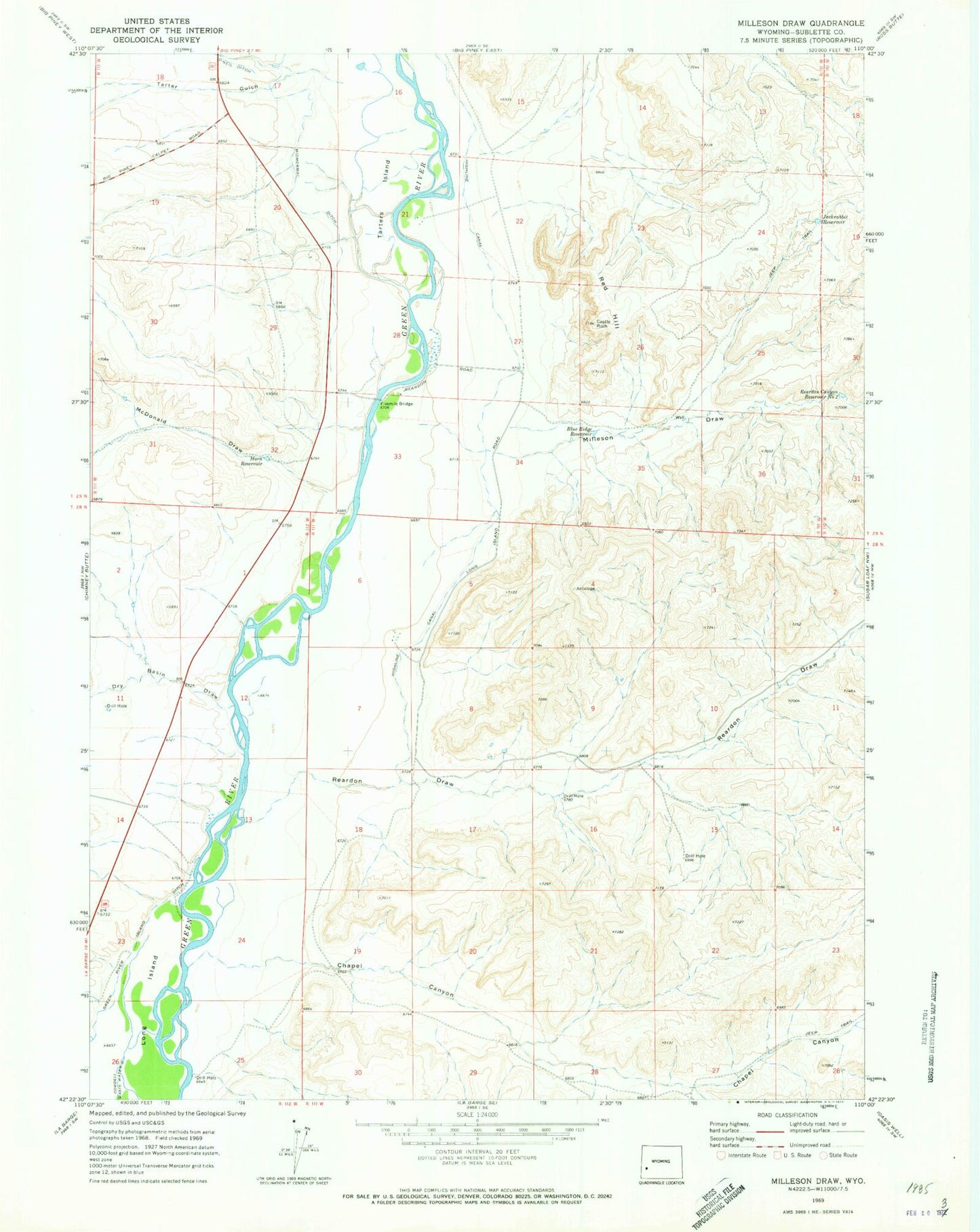
Classic USGS Milleson Draw Wyoming 7.5'x7.5' Topo Map
Couldn't load pickup availability
Historical USGS topographic quad map of Milleson Draw in the state of Wyoming. Map scale may vary for some years, but is generally around 1:24,000. Print size is approximately 24" x 27"
This quadrangle is in the following counties: Sublette.
The map contains contour lines, roads, rivers, towns, and lakes. Printed on high-quality waterproof paper with UV fade-resistant inks, and shipped rolled.
Contains the following named places: Blue Ridge Reservoir, Castle Rock, Chapel Canyon, Dry Basin Draw, Dry Piney Creek, Fivemile Bridge, Green River Island Ditch, Highline Canal, Horn Reservoir, Jackrabbit Reservoir, Long Island, McDonald Draw, Midmermac Ditch, Milleson Draw, Reardon Canyon Reservoir Number 2, Reardon Draw, Reardon Reservoir Number 3, Red Hill, Tarter Gulch, Tarters Island