MyTopo
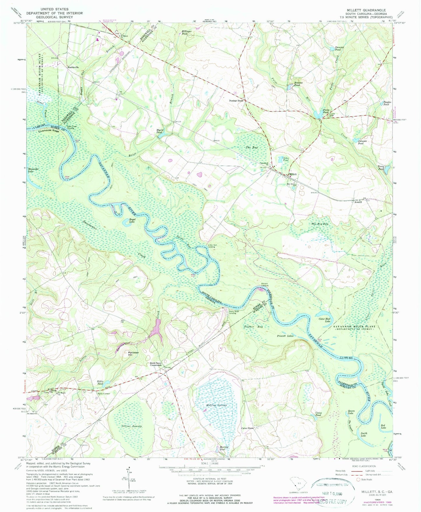
Classic USGS Millett South Carolina 7.5'x7.5' Topo Map
Couldn't load pickup availability
Historical USGS topographic quad map of Millett in the states of South Carolina, Georgia. Map scale may vary for some years, but is generally around 1:24,000. Print size is approximately 24" x 27"
This quadrangle is in the following counties: Allendale, Barnwell, Burke, Screven.
The map contains contour lines, roads, rivers, towns, and lakes. Printed on high-quality waterproof paper with UV fade-resistant inks, and shipped rolled.
Contains the following named places: Averill, Billinger Pond, Boggy Gut Branch, Brier Branch, Browns Landing, Browns Pond, Cains Pond, Cains Store, Cator Hall Lake, Clubhouse Ridge, Corinth Cemetery, Corinth Church, Devils Elbow, Dunbar School, Dunbar Store, Duncan Pond, Echee Pond, Furse Cemetery, Furse Creek, Furse Mill Pond Dam D-2563, Furse Pond, Hattieville, Hillis Corner, Hillis Pond, Hills Store, Johnson Pond, Little Hell Landing, Little Hell Point, Little Sweetwater Creek, Lower Three Runs, Martin-Millett Community Center, Millett, Millett Church, Millett Division, Millett-Rosenwald School, Mobley Swamp, Murray Pond, Myers Pond, Oliver Swamp, Peeples Pond, Potlikker Hill, Prescott Lakes, Queen Lake, Red Lake, Rock Fence Crossroads, Royal Lake, Saint Johns Church, Saint Marys Baptist Church, Saint Marys Church, Saint Marys School, Shoemaker Lake, Smith Lake, Smiths Lake, Speedwell Church, Steel Creek, Steel Creek Landing, Stoney Bluff Ferry, Stony Bluff Landing, Sweetwater Creek, Swift Gut, Telfair Bay, Terry Pond, The Bay, The Big Bay, The Lagoon, Zion Grove Church