MyTopo
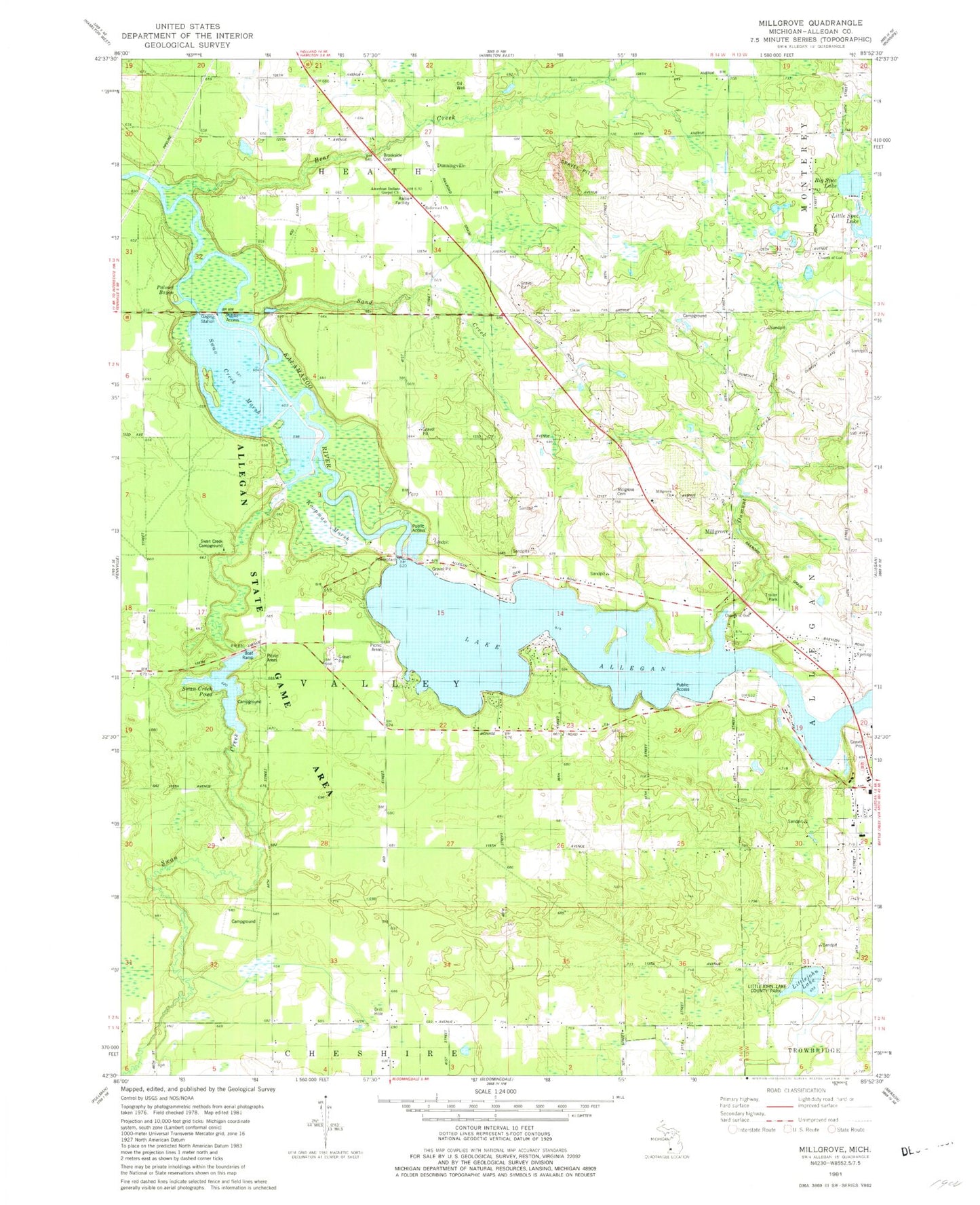
Classic USGS Millgrove Michigan 7.5'x7.5' Topo Map
Couldn't load pickup availability
Historical USGS topographic quad map of Millgrove in the state of Michigan. Typical map scale is 1:24,000, but may vary for certain years, if available. Print size: 24" x 27"
This quadrangle is in the following counties: Allegan.
The map contains contour lines, roads, rivers, towns, and lakes. Printed on high-quality waterproof paper with UV fade-resistant inks, and shipped rolled.
Contains the following named places: Allegan State Forest, Lake Allegan, Babylon School, Bear Creek, Brookside Cemetery, Diamond Chapel, Diamond School, Dumont Creek, Hillcrest School, Littlejohn Lake, Little Spec Lake, Millgrove, Moore School, Palmer Bayou, Sand Creek, Big Spec Lake, Spec Lake Chapel, Spec Lake School, Swan Creek, Swan Creek Pond, Dunningville, Swan Creek Marsh, Plainview Lookout Tower, Township of Valley, American Indian Gospel Church, Littlejohn Lake County Park, Church of God, Millgrove Church, Millgrove Cemetery, Swan Creek Campground, Church of God, Dunningville Post Office (historical), Millgrove Station (historical), Millgrove Post Office (historical), New Hope Baptist Church of Allegan, Kingdom Hall of Jehovah's Witnesses, Christ Community Church, River Church, Emmaus Road Bible Church, Homecrest Villa Mobile Home Park, Dunningville Reformed Church, Pine Point Campground, Allegan Cross Country Ski Area, Dunningville Station (historical), Michigan Department of Natural Resources Allegan Field Office