MyTopo
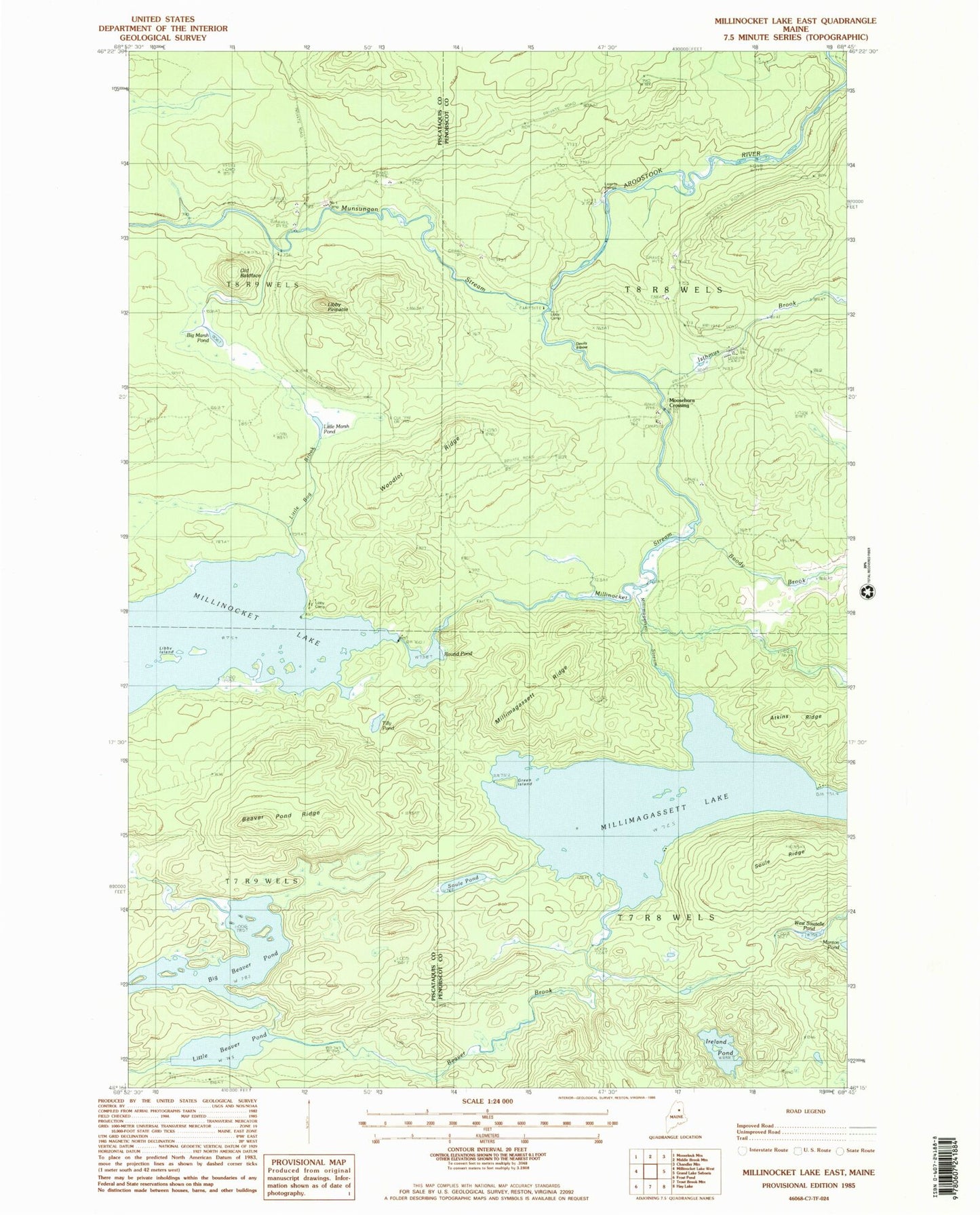
Classic USGS Millinocket Lake East Maine 7.5'x7.5' Topo Map
Couldn't load pickup availability
Historical USGS topographic quad map of Millinocket Lake East in the state of Maine. Typical map scale is 1:24,000, but may vary for certain years, if available. Print size: 24" x 27"
This quadrangle is in the following counties: Penobscot, Piscataquis.
The map contains contour lines, roads, rivers, towns, and lakes. Printed on high-quality waterproof paper with UV fade-resistant inks, and shipped rolled.
Contains the following named places: Atkins Ridge, Beaver Brook, Beaver Pond Ridge, Big Beaver Pond, Big Marsh Pond, Boody Brook, Devils Elbow, Green Island, Ireland Pond, Isthmus Brook, Libby Camp, Libby Camp, Libby Island, Libby Pinnacle, Little Beaver Pond, Little Bog Brook, Little Marsh Pond, Millimagassett Lake, Millimagassett Ridge, Millimagassett Stream, Millinocket Falls, Millinocket Lake, Millinocket Stream, Munsungan Lake Tote Road, Munsungan Stream, Number One Camp, Old Baldface, Round Pond, Soule Pond, Soule Ridge, Tilly Pond, West Sawtelle Pond, Woodlot Ridge, Moosehorn Crossing, Millinocket Lake Dam, T7 R8 WELS, T8 R8 WELS