MyTopo
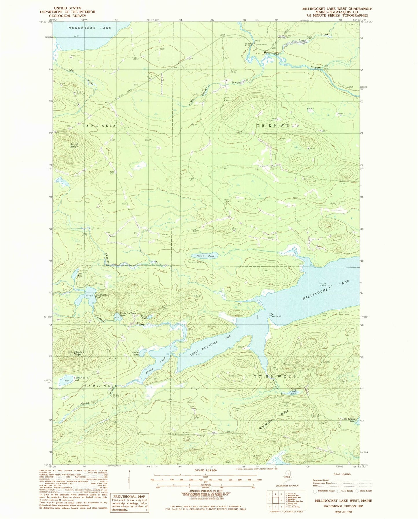
Classic USGS Millinocket Lake West Maine 7.5'x7.5' Topo Map
Couldn't load pickup availability
Historical USGS topographic quad map of Millinocket Lake West in the state of Maine. Map scale may vary for some years, but is generally around 1:24,000. Print size is approximately 24" x 27"
This quadrangle is in the following counties: Piscataquis.
The map contains contour lines, roads, rivers, towns, and lakes. Printed on high-quality waterproof paper with UV fade-resistant inks, and shipped rolled.
Contains the following named places: Aroostook Brook, Atkins Pond, Big Caribou Pond, Brown Brook, Caribou Brook, Caribou Ridge, Cedar Brook, Chandler Brook, Elsie Pond, Ervin Pond, Jack Pond, Kyle Pond, Little Caribou Pond, Little Millinocket Lake, Little Moose Pond, Little Munsungan Stream, Millinocket Ridge, Moose Brook, Moose Pond, Munsungan Falls, Munsungan Lake, South Ridge, T7 R9 WELS, T8 R9 WELS, The Thorofare, Willard Brook, ZIP Code: 04732