MyTopo
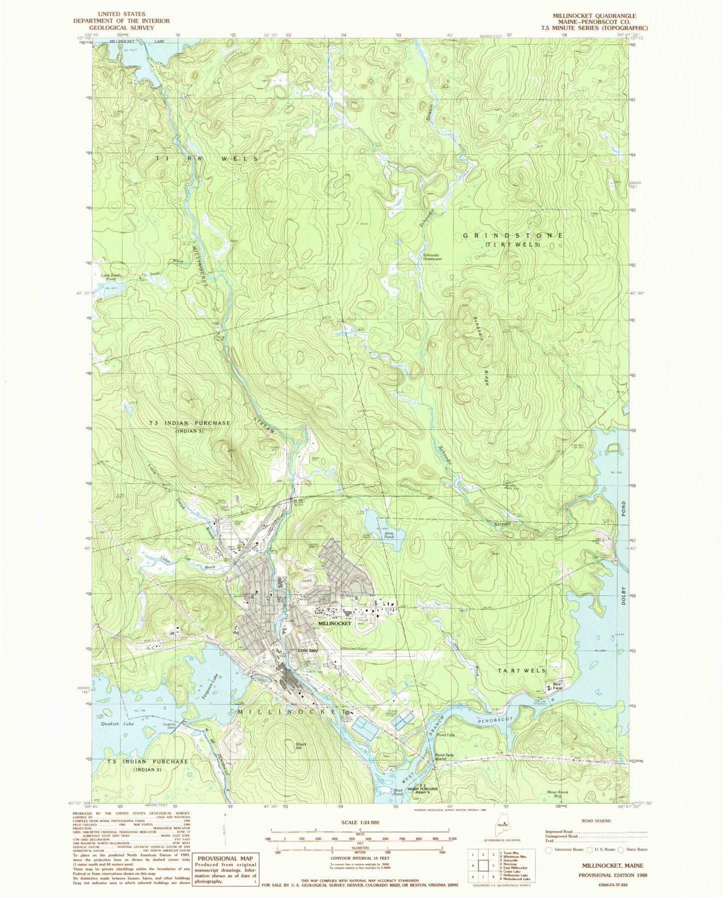
Classic USGS Millinocket Maine 7.5'x7.5' Topo Map
Couldn't load pickup availability
Historical USGS topographic quad map of Millinocket in the state of Maine. Map scale may vary for some years, but is generally around 1:24,000. Print size is approximately 24" x 27"
This quadrangle is in the following counties: Penobscot.
The map contains contour lines, roads, rivers, towns, and lakes. Printed on high-quality waterproof paper with UV fade-resistant inks, and shipped rolled.
Contains the following named places: Aroostook Avenue School, Bowden, Church of the Nazarene, Ferguson Lake, First Congregational Church, First Pentecostal Church, Granite Street Elementary School, Grindstone Township, Jerry Brook, Jerry Pond, Katahdin Avenue School, Ledge Cut Brook, Little Italy, Little Smith Brook, Little Smith Pond, Millinocket, Millinocket Baptist Church, Millinocket Cemetery, Millinocket Census Designated Place, Millinocket Fire Department, Millinocket High School, Millinocket Lake Dam, Millinocket Memorial Library, Millinocket Municipal Airport, Millinocket Police Department, Millinocket Post Office, Millinocket Regional Hospital, Millinocket Regional Hospital Medical Library, Millinocket Stream, Pond Falls Island, Quakish Dam, Rice Farm, Saint Martin of Tours Catholic Church, Saint Martin of Tours Cemetery, Schoodic Deadwater, Schoodic Ridge, Schoodic Stream, Shack Hill, Smith Brook, Smith Brook Deadwater, Stearns High School, Stearns Junior Senior High School, Town of Millinocket, Union Chapel, WSYY-AM (Millinocket), WSYY-FM (Millinocket)