MyTopo
Classic USGS Millis Wyoming 7.5'x7.5' Topo Map
Couldn't load pickup availability
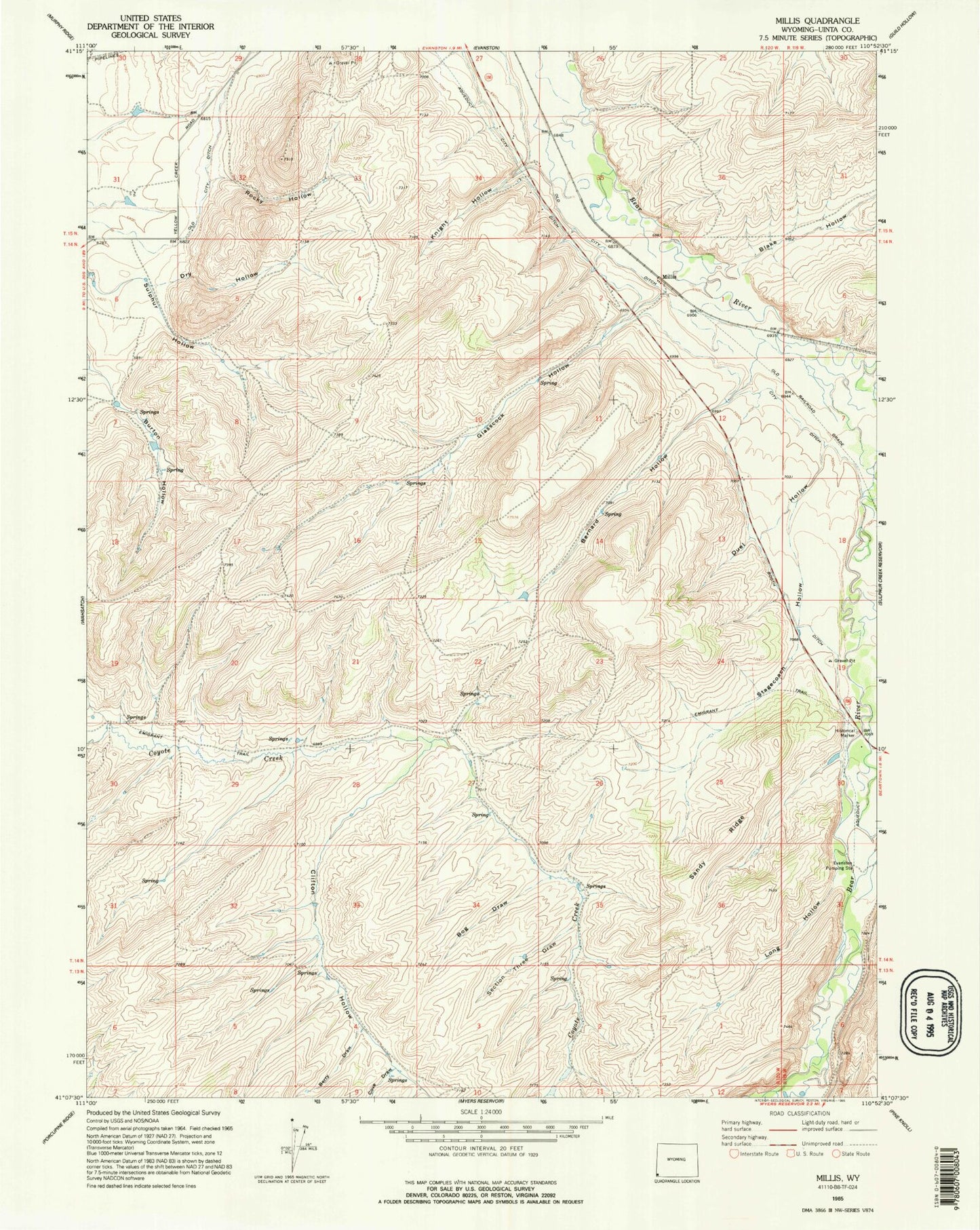
Historical USGS topographic quad map of Millis in the state of Wyoming. Map scale may vary for some years, but is generally around 1:24,000. Print size is approximately 24" x 27"
This quadrangle is in the following counties: Uinta.
The map contains contour lines, roads, rivers, towns, and lakes. Printed on high-quality waterproof paper with UV fade-resistant inks, and shipped rolled.
Contains the following named places: Bernard Hollow, Berry Draw, Blake Hollow, Bog Draw, Clifton Hollow, Cove Draw, Dry Hollow, Duel Hollow, East Dam, East Reservoir, Emigrant Trail, Evanston Pumping Station, Evanston Regional Hospital, Glasscock Hollow, Jamison Claim, Knight Hollow, Long Hollow, Meadow Draw, Rocky Hollow, Sandy Ridge, Section Three Draw, Spring Creek, Stagecoach Hollow, Stowe Creek, Uinta County Fire Protection Evanston Station 3