MyTopo
Classic USGS Millport Kentucky 7.5'x7.5' Topo Map
Couldn't load pickup availability
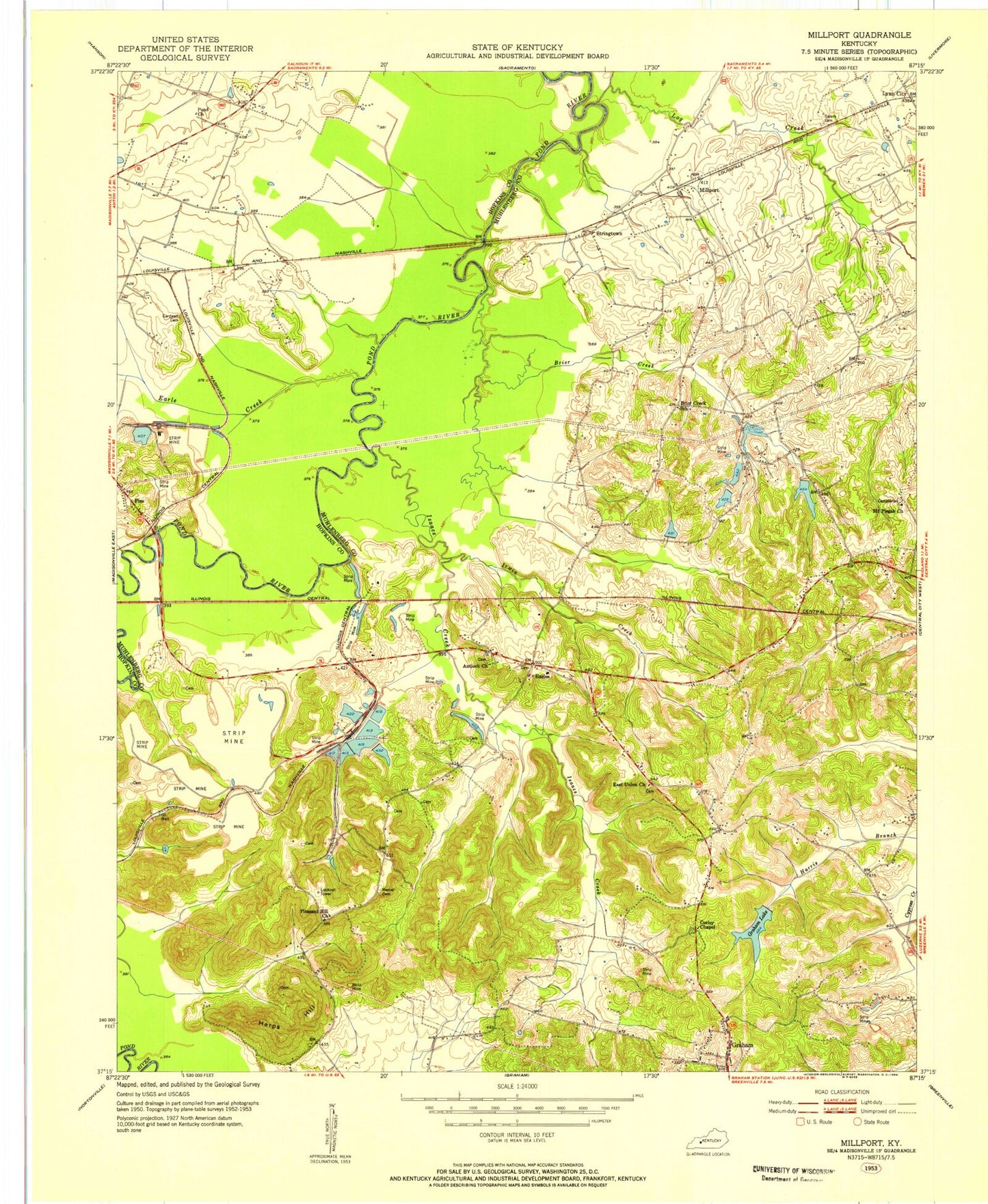
Historical USGS topographic quad map of Millport in the state of Kentucky. Map scale may vary for some years, but is generally around 1:24,000. Print size is approximately 24" x 27"
This quadrangle is in the following counties: Hopkins, Muhlenberg.
The map contains contour lines, roads, rivers, towns, and lakes. Printed on high-quality waterproof paper with UV fade-resistant inks, and shipped rolled.
Contains the following named places: Antioch Church, Bremen Division, Briar Creek, Brier Creek, Brier Creek School, Cardwell Cemetery, Corley Chapel, Earle Creek, Earles, East Union, East Union Church, Fies, Graham, Graham Lake, Harpes Hill Valley, Harps Hill, Irwin Creek, Isaacs Creek, Jagoe, Log Creek, Lynn City, McDonalds, Mercer Cemetery, Millport, Mount Pisgah Church, Pond Church, Salem Cemetery, Sandy, Stringtown, ZIP Codes: 42325, 42344