MyTopo
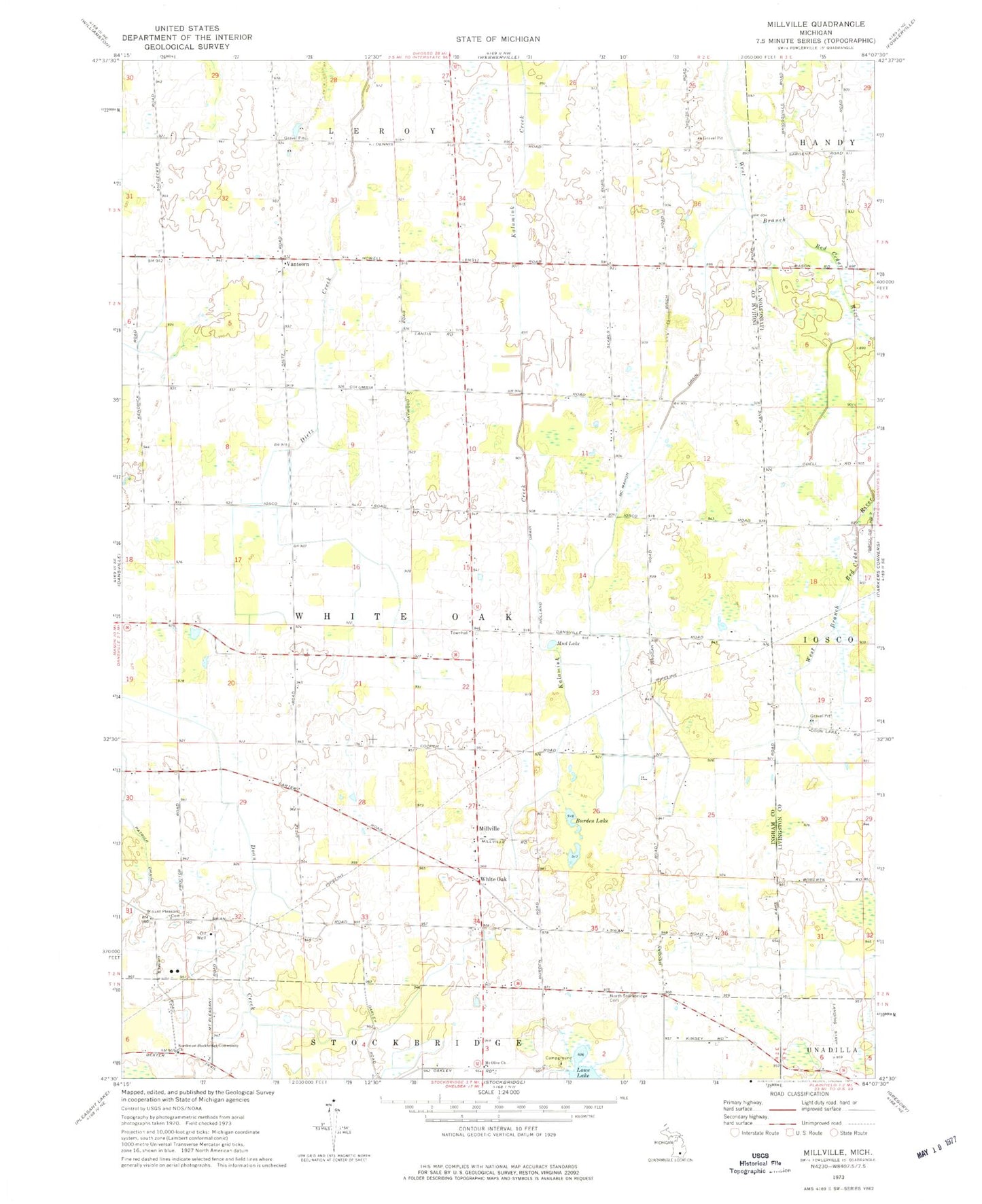
Classic USGS Millville Michigan 7.5'x7.5' Topo Map
Couldn't load pickup availability
Historical USGS topographic quad map of Millville in the state of Michigan. Map scale may vary for some years, but is generally around 1:24,000. Print size is approximately 24" x 27"
This quadrangle is in the following counties: Ingham, Livingston.
The map contains contour lines, roads, rivers, towns, and lakes. Printed on high-quality waterproof paper with UV fade-resistant inks, and shipped rolled.
Contains the following named places: Burden Lake, Cloud Nine West Airport, Good Shepherd Mission, Harris Post Office, Holland Drain, McMahon Drain, Middletown Post Office, Millville, Millville United Methodist Church, Mount Olive Church, Mount Pleasant Cemetery, Mud Lake, North Stockbridge Cemetery, Northwest Stockbridge Community Church, Patrick Drain, Township of White Oak, Vantown, Vantown Community Church, Vantown Post Office, White Oak, White Oak Township Hall Historical Marker, Whiteoak Post Office