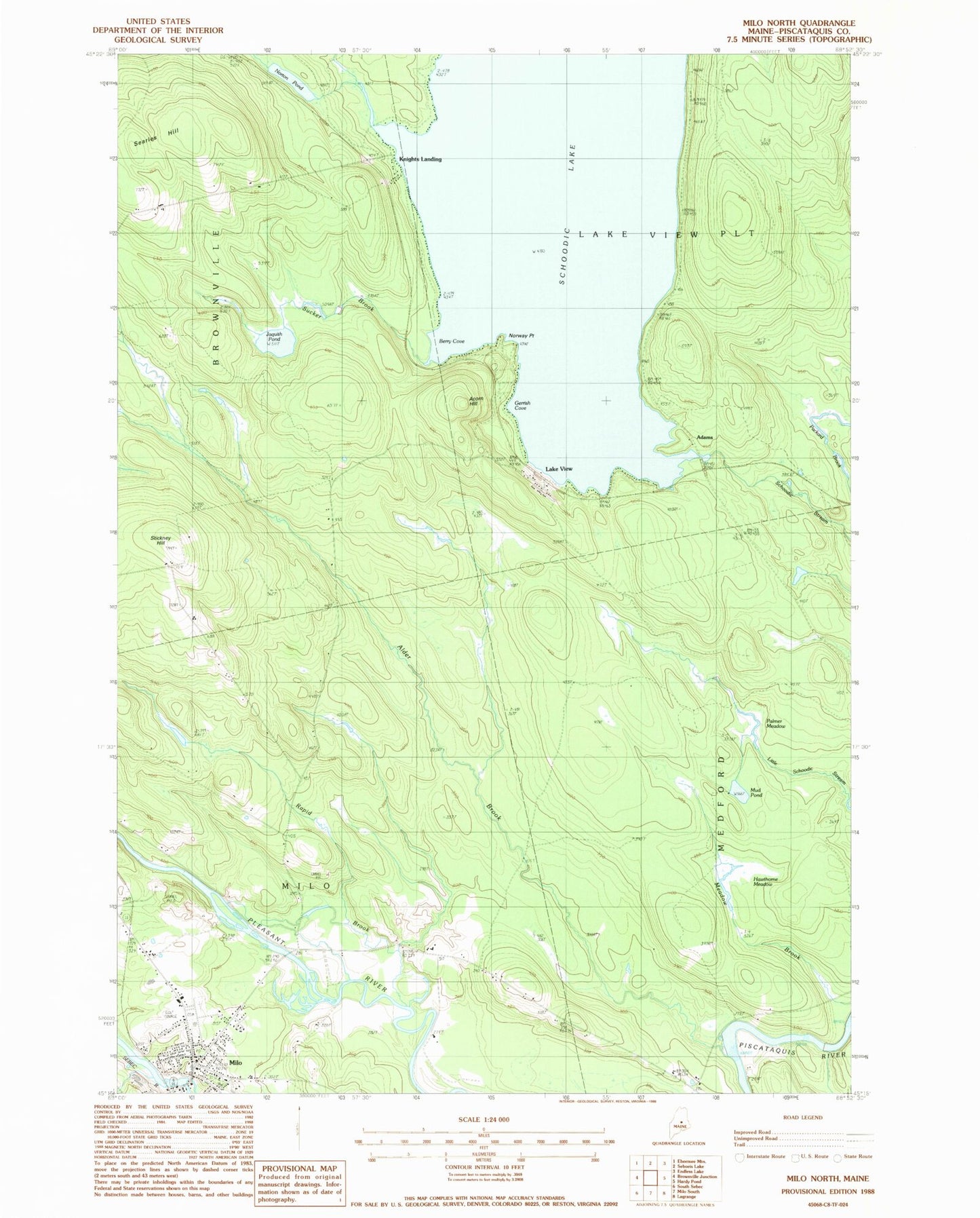
MyTopo
Classic USGS Milo North Maine 7.5'x7.5' Topo Map
Couldn't load pickup availability
Historical USGS topographic quad map of Milo North in the state of Maine. Typical map scale is 1:24,000, but may vary for certain years, if available. Print size: 24" x 27"
This quadrangle is in the following counties: Piscataquis.
The map contains contour lines, roads, rivers, towns, and lakes. Printed on high-quality waterproof paper with UV fade-resistant inks, and shipped rolled.
Contains the following named places: Acorn Hill, Alder Brook, Berry Cove, Evergreen Cemetery, Gerrish Cove, Hawthorne Meadow, Jaquith Pond, Lake View, Milo, Mud Pond, Norton Pond, Norway Point, Palmer Meadow, Rapid Brook, Schoodic Lake, Searles Hill, Stickney Hill, Sucker Brook, Adams, Knights Landing, Town of Milo, Schoodic Lake Dam, Milo Dam, Sebec River Reservoir, Katahdin Country Club, Milo Elementary School, Milo Free Public Library, Milo Post Office, Penquis Valley Middle / High School, Penquis Valley Middle School, Milo Fire Station, Three Rivers Ambulance Service, Milo Police Department