MyTopo
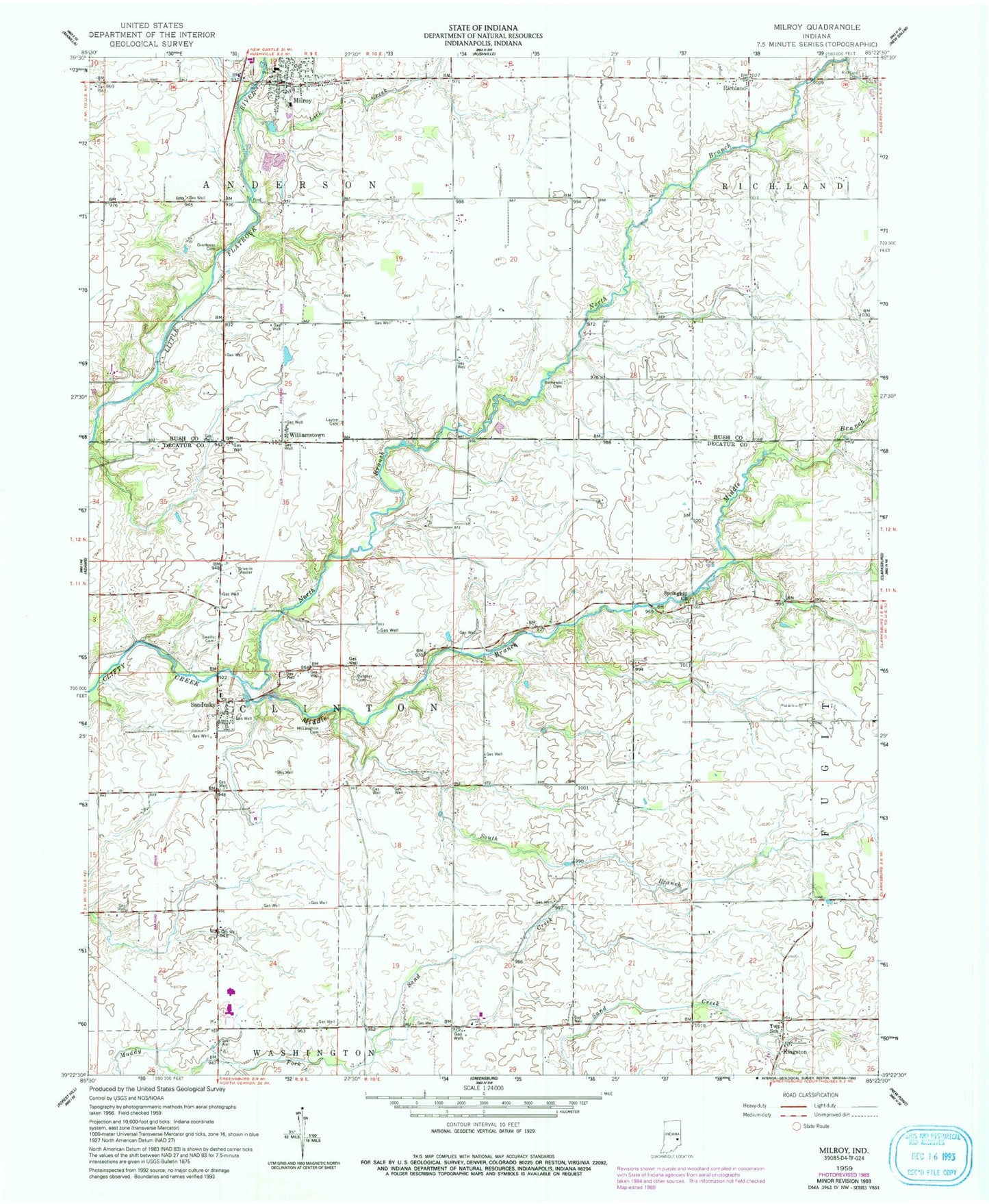
Classic USGS Milroy Indiana 7.5'x7.5' Topo Map
Couldn't load pickup availability
Historical USGS topographic quad map of Milroy in the state of Indiana. Map scale may vary for some years, but is generally around 1:24,000. Print size is approximately 24" x 27"
This quadrangle is in the following counties: Decatur, Rush.
The map contains contour lines, roads, rivers, towns, and lakes. Printed on high-quality waterproof paper with UV fade-resistant inks, and shipped rolled.
Contains the following named places: Anderson Township Volunteer Fire Department, Bethesda Cemetery, Butcher Cemetery, Kingston, Kingston Cemetery, Layton Cemetery, Lick Creek, McLaughlin Cemetery, Middle Branch Clifty Creek, Milroy, Milroy Census Designated Place, Milroy Elementary and Junior High School, Milroy Emergency Medical Services, Milroy Post Office, North Branch Clifty Creek, Old Richland Methodist Cemetery, Overleese Cemetery, Richland, Sandusky, South Branch Clifty Creek, Springhill, Springhill Cemetery, Springhill Church, Swails Cemetery, Township of Anderson, Township of Clinton, Williamstown, ZIP Code: 46156