MyTopo
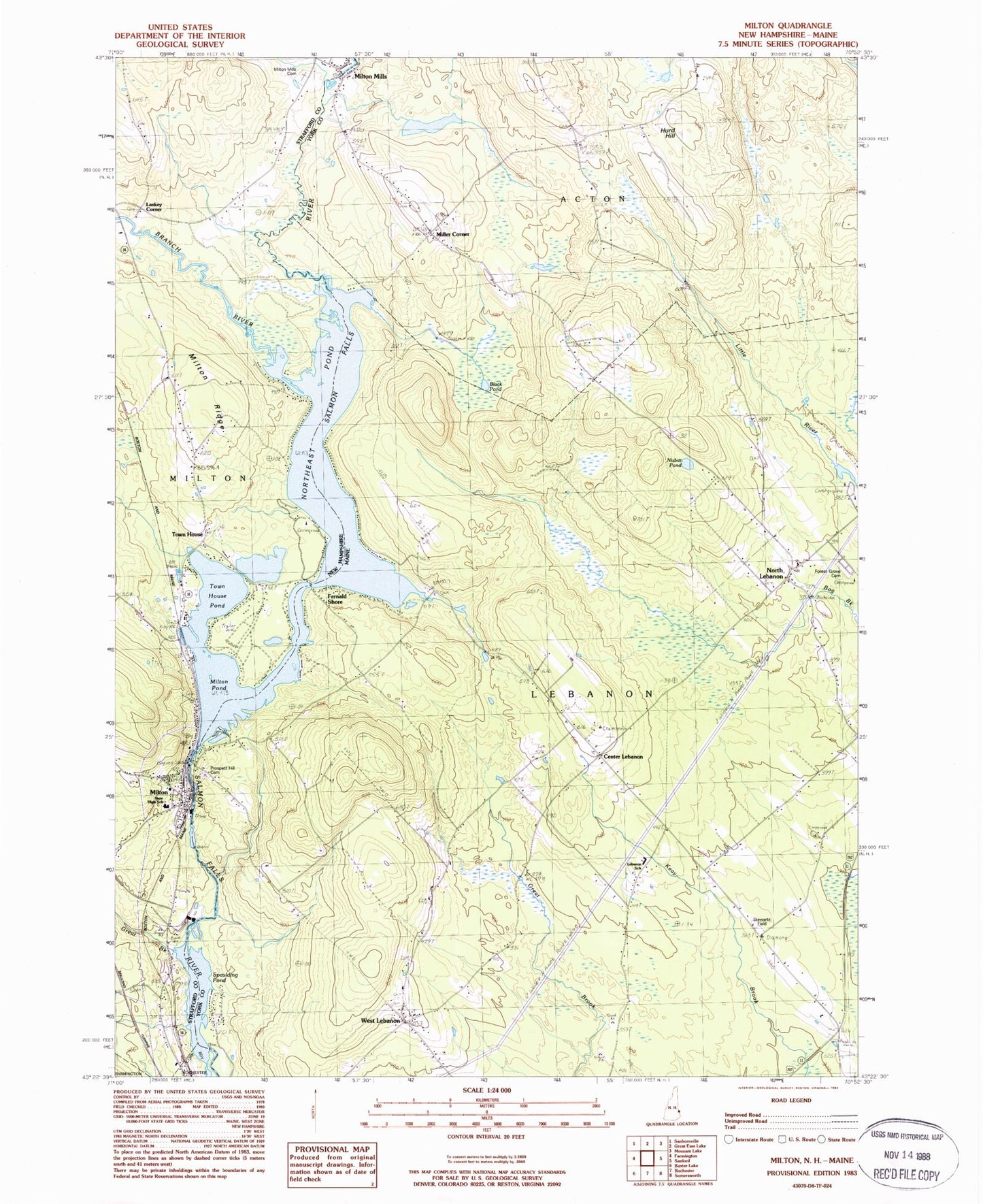
Classic USGS Milton New Hampshire 7.5'x7.5' Topo Map
Couldn't load pickup availability
Historical USGS topographic quad map of Milton in the states of New Hampshire, Maine. Typical map scale is 1:24,000, but may vary for certain years, if available. Print size: 24" x 27"
This quadrangle is in the following counties: Strafford, York.
The map contains contour lines, roads, rivers, towns, and lakes. Printed on high-quality waterproof paper with UV fade-resistant inks, and shipped rolled.
Contains the following named places: Spaulding Pond, Spaulding Pond, Great Brook, Branch River, Laskey Corner, Miller Brook, Milton, Milton Mills Cemetery, Milton Ridge, Northeast Pond, Town House, Town House Pond, Milton Leather Board Dam, Salmon Falls River Reservoir, Milton Three Ponds Dam, Spaulding Dam, Milton Elementary School, Milton Mills Post Office, Milton Post Office, New Hampshire Farm Museum, Nute High School and Middle School, Milton Learning Center, Milton Fire Rescue Central Station, Milton Census Designated Place, Milton Police Department, Black Pond, Center Lebanon, Fernald Shore, Forest Grove Cemetery, Hurd Hill, Miller Corner, Nisbitt Pond, North Lebanon, Northeast Pond, Prospect Hill Cemetery, Spaulding Pond, Spaulding Pond, West Lebanon, Town of Lebanon, Milton Pond, Prospect Hill Cemetery, Bridge Street Dam, Mousam River Reservoir, Milton Three Ponds, Lebanon Area Library, Lebanon Elementary School, North Lebanon Second Baptist Church, Potters Place Adult Park Campground, Stewarts Field, West Lebanon Historic District, Maple Stone School, Martha Sawyer Community Library