MyTopo
Classic USGS Mineral City Ohio 7.5'x7.5' Topo Map
Couldn't load pickup availability
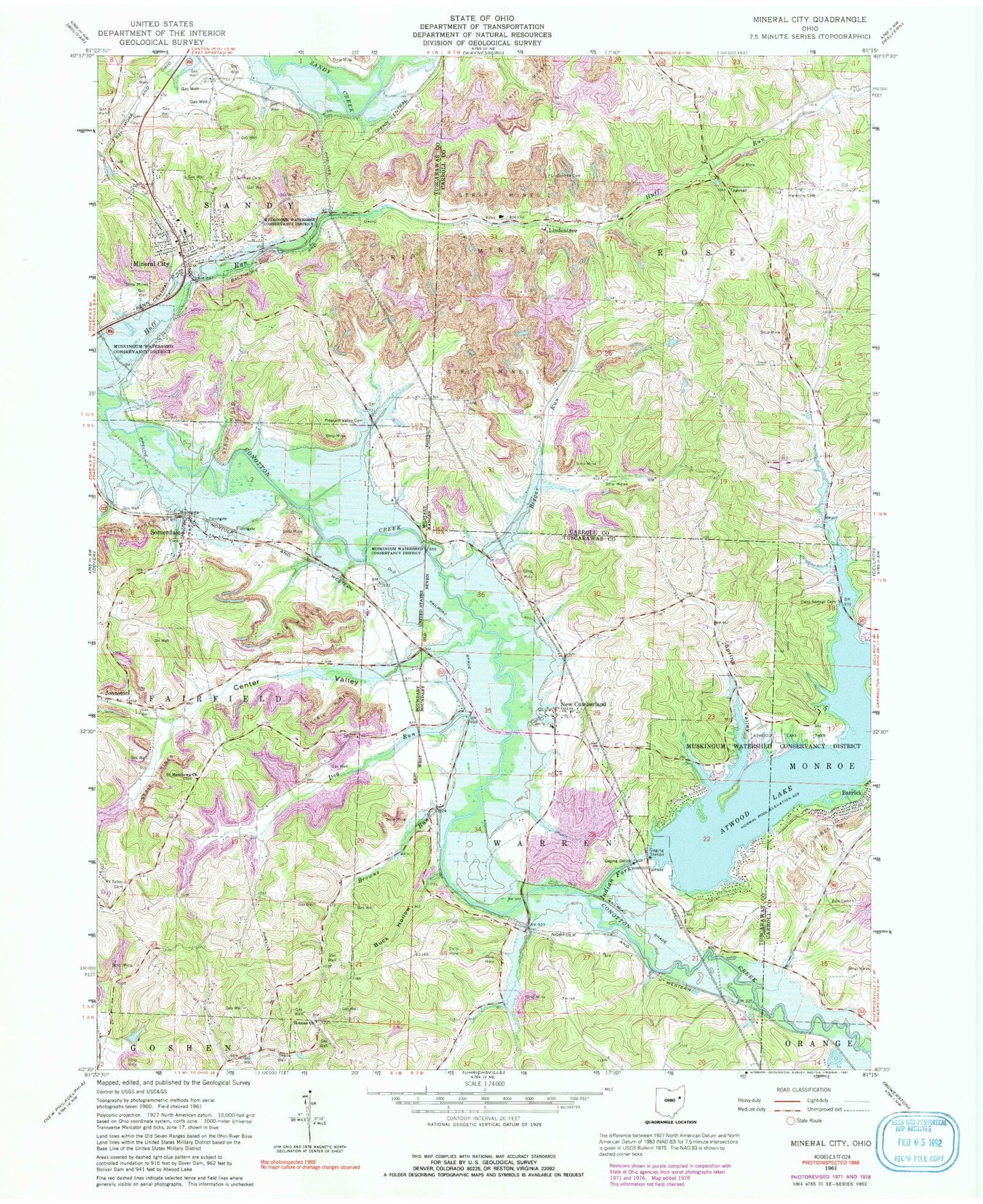
Historical USGS topographic quad map of Mineral City in the state of Ohio. Map scale may vary for some years, but is generally around 1:24,000. Print size is approximately 24" x 27"
This quadrangle is in the following counties: Carroll, Tuscarawas.
The map contains contour lines, roads, rivers, towns, and lakes. Printed on high-quality waterproof paper with UV fade-resistant inks, and shipped rolled.
Contains the following named places: Atwood Dam, Atwood Lake, Atwood Lake Park, Atwood Marina West, Barrick, Beggar Run, Blue Ribbon Farm, Browns Run, Buck Hollow, Center Valley, Deep Springs Cemetery, Dog Run, Dog Run School, Dolly Varden School, Dutchtown, Egypt, Fairfield Township Volunteer Fire Department, German Cemetery, Glens Cottage Area, Harmony Cemetery, Holmes Church, Holmes Methodist Episcopal Cemetery, Indian Fork, Johnston, Lindentree, Lindentree Cemetery, Lindentree Post Office, Little Fraction School, Mineral - Sandy Ambulance District, Mineral City, Mineral City Catholic Cemetery, Mineral City Cemetery, Mineral City Elementary School, Mineral City Post Office, Mineral City Volunteer Fire Department, Mount Tabor, Mount Tabor Cemetery, New Cumberland, New Cumberland Elementary School, New Cumberland Post Office, North Shore Cottage Area, Pleasant Valley Cemetery, Robertson School, Saint Matthews Cemetery, Saint Matthews Church, Somerdale, Somerdale Cemetery, Somerdale Post Office, Spring Valley, Sunset Valley, Tall Timber Lake, Tall Tinber Lake Dam, Township of Fairfield, Township of Rose, Township of Sandy, Township of Warren, Tunnel School, Village of Mineral City, Walnut Grove School, Zion Cemetery, ZIP Codes: 44656, 44675, 44678