
MyTopo
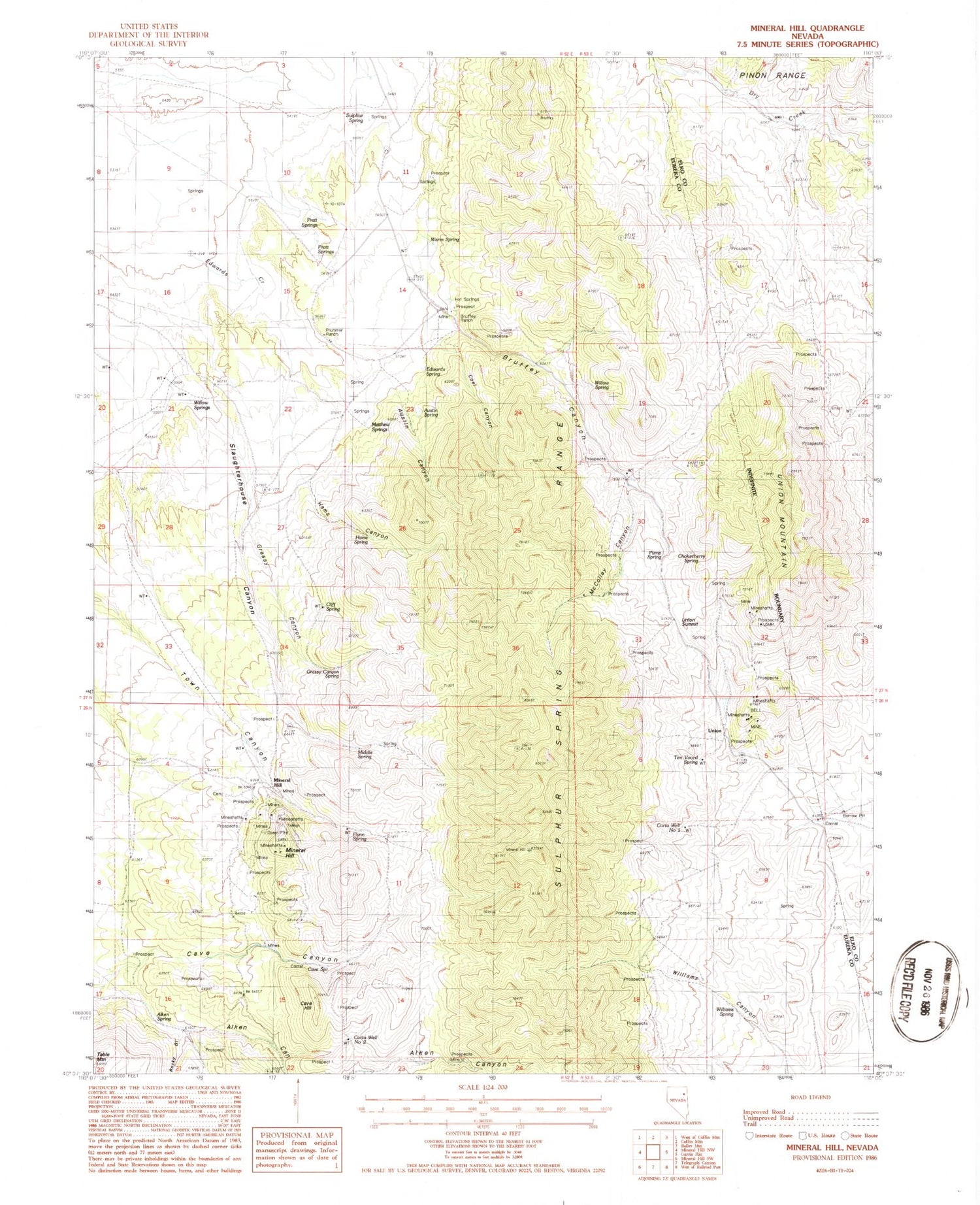
Classic USGS Mineral Hill Nevada 7.5'x7.5' Topo Map
Couldn't load pickup availability
Historical USGS topographic quad map of Mineral Hill in the state of Nevada. Map scale may vary for some years, but is generally around 1:24,000. Print size is approximately 24" x 27"
This quadrangle is in the following counties: Elko, Eureka.
The map contains contour lines, roads, rivers, towns, and lakes. Printed on high-quality waterproof paper with UV fade-resistant inks, and shipped rolled.
Contains the following named places: Aiken Spring, Austin Canyon, Austin Mine, Austin Spring, Bell Mine, Bruffey Canyon, Bruffey Ranch, Bruffeys Hot Springs, Cave Hill, Cave Spring, Chokecherry Spring, Cliff Spring, Coal Canyon, Corta Well Number One, Corta Well Number Two, Edwards Spring, Flynn Spring, Grant Mine, Grassy Canyon, Grassy Canyon Spring, Hams Canyon, Hams Spring, Mary Ann Mine, Matthew Springs, McColley Canyon, Middle Spring, Mineral Hill, Mineral Hill Mines, Mineral Hill Mining District, Mineral Hill Post Office, N-T Spring, Plummer Ranch, Pogonip Mine, Pratt Springs, Pump Spring, Rim Rock Mine, Rocky Gulch, Sherwood Post Office, Slaughterhouse Canyon, Star of the West Mine, Sulphur Spring, Sulphur Spring Range, Ten Voord Spring, Town Canyon, Union Mines Post Office, Union Mining District, Union Mountain, Union Summit, Vallejo Mine, Warm Spring, Williams Canyon, Williams Spring, Willow Spring, Willow Springs


