MyTopo
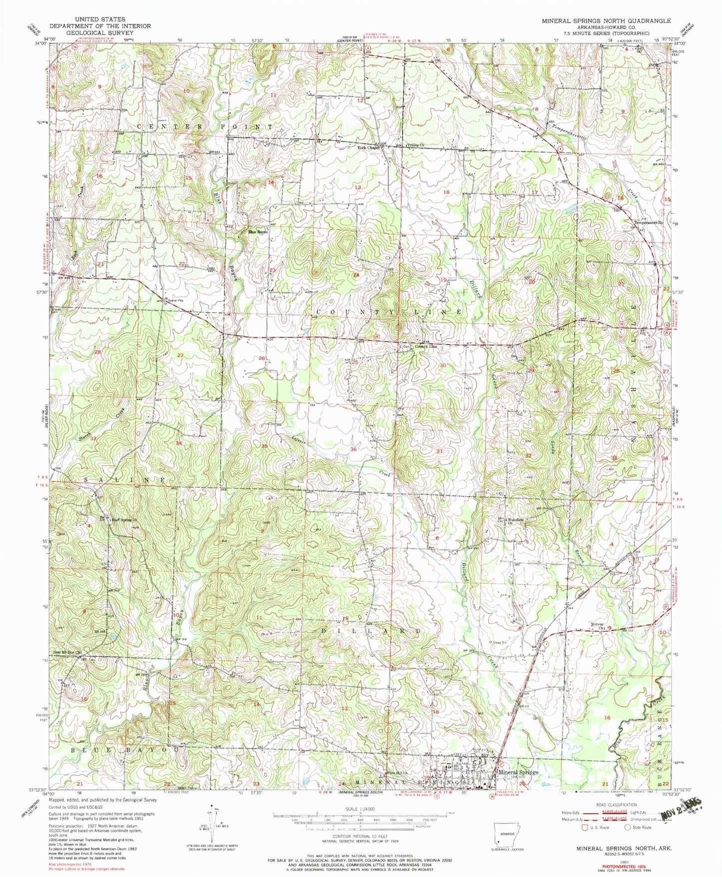
Classic USGS Mineral Springs North Arkansas 7.5'x7.5' Topo Map
Couldn't load pickup availability
Historical USGS topographic quad map of Mineral Springs North in the state of Arkansas. Map scale may vary for some years, but is generally around 1:24,000. Print size is approximately 24" x 27"
This quadrangle is in the following counties: Howard.
The map contains contour lines, roads, rivers, towns, and lakes. Printed on high-quality waterproof paper with UV fade-resistant inks, and shipped rolled.
Contains the following named places: Amity, Baber Store, Bayou Store, Blue Bayou, Blue Bayou Church, Bluff Spring Church, Bluff Springs Cemetery, City of Mineral Springs, County Line, County Line Cemetery, County Line Church, County Line Rural Volunteer Fire Department, Dildy School, Dillard School, Flint Hill Church, Forgy, Forty Five School, Glenn Winchester Airport, Holcombe Store, Howard Memorial Hospital, Kirby School, Lefever Creek, Little Bayou, Midway, Midway Church, Mineral Springs, Mineral Springs Elementary School, Mineral Springs High School, Mineral Springs Police Department, Mineral Springs School, Mount Olive, New Mount Zion Church, Old 45 School, Plainview Church, Rock Springs School, Sandy Branch, Shiloh Cemetery, Temperanceville, Temperanceville Cemetery, Temperanceville Church, Township of County Line, Township of Dillard, Trinity Methodist Church, University of Arkansas Peach Experiment Station, Wakefield, Wakefield Church, York Chapel, Yorks Chapel School