MyTopo
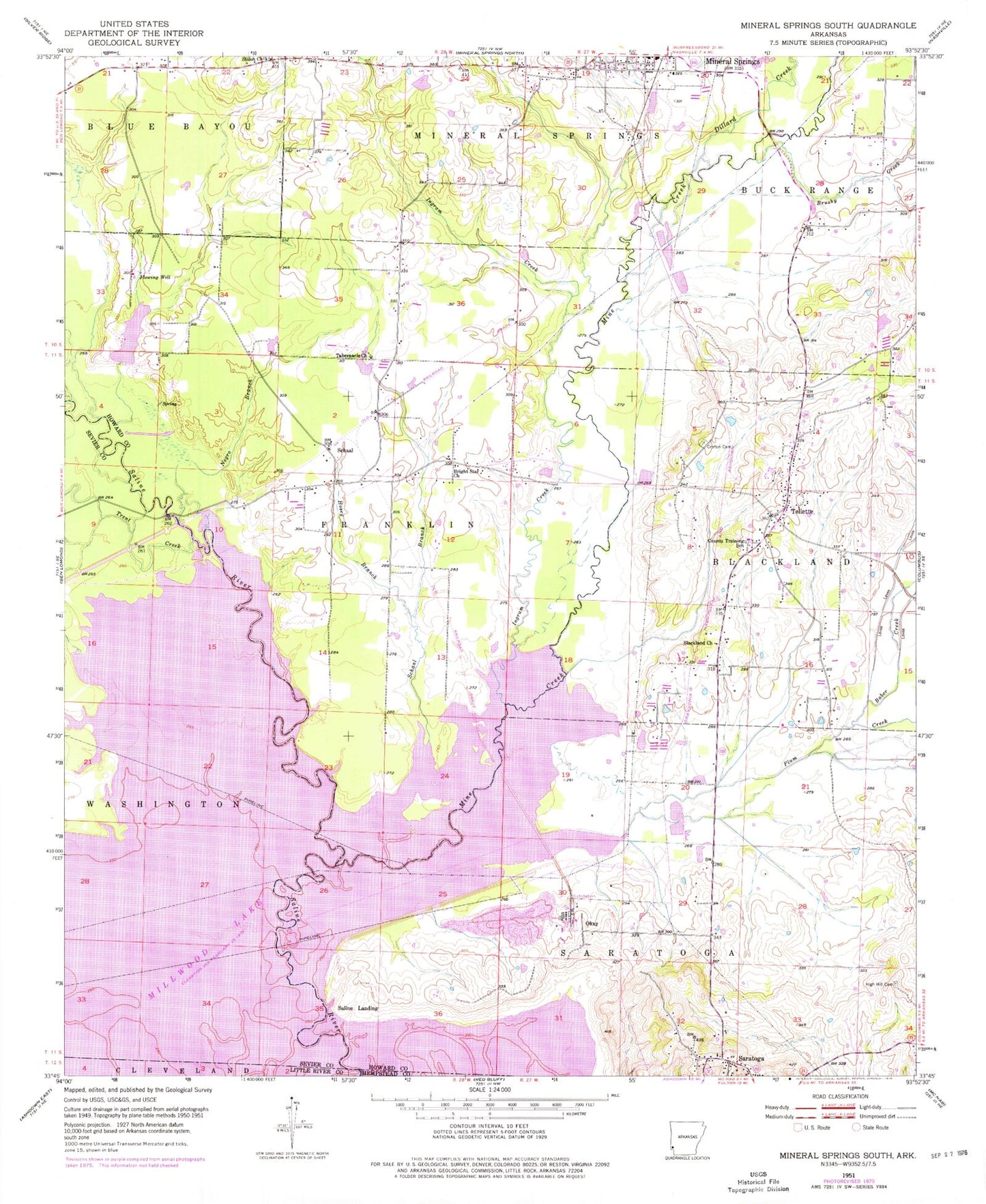
Classic USGS Mineral Springs South Arkansas 7.5'x7.5' Topo Map
Couldn't load pickup availability
Historical USGS topographic quad map of Mineral Springs South in the state of Arkansas. Map scale may vary for some years, but is generally around 1:24,000. Print size is approximately 24" x 27"
This quadrangle is in the following counties: Hempstead, Howard, Little River, Sevier.
The map contains contour lines, roads, rivers, towns, and lakes. Printed on high-quality waterproof paper with UV fade-resistant inks, and shipped rolled.
Contains the following named places: Allbrook, Baber Creek, Blackland Church, Bright Star Church, Brushy Creek, Bucky Range School, Cottonshed Landing, Cottonshed Landing Use Area, Cottonshed Volunteer Fire Department, Crofton Academy, Crofton Cemetery, Devils Backbone, Dillard Creek, Hickory Grove Church, Hickory Grove School, High Hill Cemetery, Hosey Branch, Howard County High School, Ingram Creek, Kever Lake, Kever Lake Dam, Mine Creek, Mineral Springs Post Office, Mineral Springs Volunteer Fire Station, Negro Branch, Okay, Okay Dike, Okay Dike Use Area, Okay School, Plum Creek, Saline Landing, Saline Landing Bridge, Saratoga, Saratoga Post Office, Saratoga Volunteer Fire Department, Schaal, Schaal Branch, Schaal School, Scotty Lake, Scotty Lake Dam, Shiloh Church, Shiloh School, Shirley Cemetery, Steel Bridge, Tabernacle Church, Tollette, Tollette Volunteer Fire Department, Town of Tollette, Township of Blackland, Township of Franklin, Township of Mineral Springs, Township of Saratoga, Township of Tollette, Trent Creek, Wood Side Bridge, ZIP Code: 71851