MyTopo
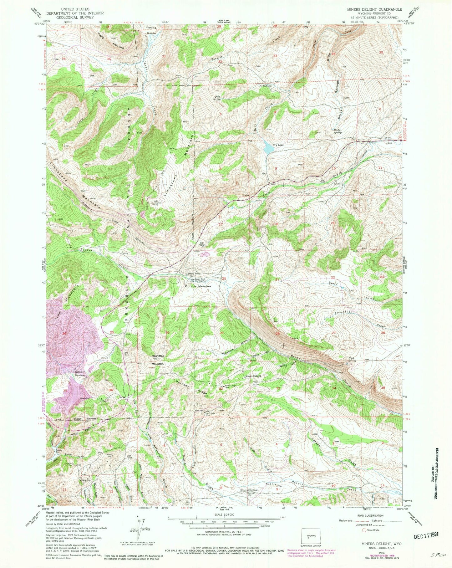
Classic USGS Miners Delight Wyoming 7.5'x7.5' Topo Map
Couldn't load pickup availability
Historical USGS topographic quad map of Miners Delight in the state of Wyoming. Map scale may vary for some years, but is generally around 1:24,000. Print size is approximately 24" x 27"
This quadrangle is in the following counties: Fremont.
The map contains contour lines, roads, rivers, towns, and lakes. Printed on high-quality waterproof paper with UV fade-resistant inks, and shipped rolled.
Contains the following named places: Arasta Gulch, Atlantic City Census Designated Place, Baltic Gulch, Beaver Creek Counting Pens, Buckeye Gulch, Caribou Mine, Cole Gulch, Columbia Geneva Mines, Copper Chief Gold Mine, Crows Nest Gulch, Cutler Gulch, Derby Spring, Derby Springs Draw, Diana Mine, Dry Lake, Fire King Deposit, Fort Stambaugh Historical, Garfield Mine, Gold Dollar Mine, Goldman Meadows, High Spring, Horace Gulch, Irish Gulch, KCWC-FM (Riverton), KCWC-TV (Lander), Lander Division, Meadow Gulch, Midas Mine, Miners Delight, Miners Delight Cemetery, Miners Delight Mine, Omera Meadow, Omera Spring, Pat Royce Spring, Peabody Ridge, Pine Spring, Placerita Gulch, Promise Gulch, Red Canyon Rim Mine, Rock Creek Mine, Roundtop Mountain, Sheldon Gulch, Slate Creek, Snow Creek, South Pass Ski Tow, Spring Gulch, Yankee Gulch