
MyTopo
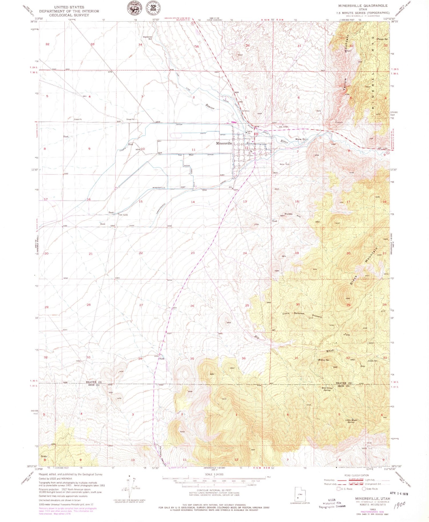
Classic USGS Minersville Utah 7.5'x7.5' Topo Map
Couldn't load pickup availability
Historical USGS topographic quad map of Minersville in the state of Utah. Map scale may vary for some years, but is generally around 1:24,000. Print size is approximately 24" x 27"
This quadrangle is in the following counties: Beaver, Iron.
The map contains contour lines, roads, rivers, towns, and lakes. Printed on high-quality waterproof paper with UV fade-resistant inks, and shipped rolled.
Contains the following named places: Beaver County Fire District - Minersville, Big Wash, Big Wash Debris Basin Dam, Big Wash Debris Basin Reservoir, Black Mountain, Joads Spring, Little Maple Spring, Minersville, Minersville Canal, Minersville Cemetery, Minersville Post Office, Minersville School, Muddy Hill, North Ditch, North Dotson Gillins Ditch, Parowan Canyon, Parowan Canyon Wash, Plunge Spring, The Church of Jesus Christ of Latter Day Saints, The Mile Ditch, Town of Minersville, Uncle Benneys Orchard, Utopia Ditch, Willow Spring, Wire Grass Spring, Woods James Ditch


