MyTopo
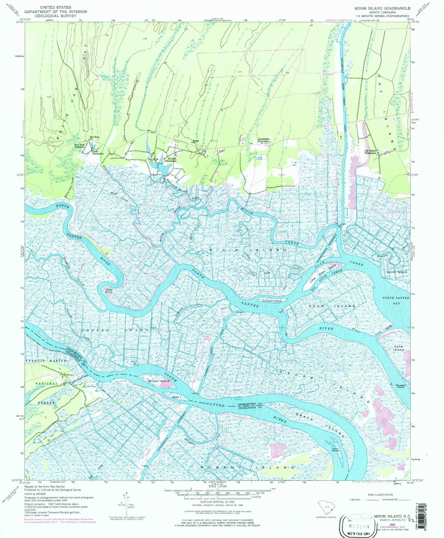
Classic USGS Minim Island South Carolina 7.5'x7.5' Topo Map
Couldn't load pickup availability
Historical USGS topographic quad map of Minim Island in the state of South Carolina. Map scale may vary for some years, but is generally around 1:24,000. Print size is approximately 24" x 27"
This quadrangle is in the following counties: Charleston, Georgetown.
The map contains contour lines, roads, rivers, towns, and lakes. Printed on high-quality waterproof paper with UV fade-resistant inks, and shipped rolled.
Contains the following named places: Alligator Creek, Annandale Plantation, Atchison Creek, Bethel Church, Big Duck Creek, Black Out Plantation, Bluff Creek, Brown Island, Cane Creek, Cane Island, Cat Island Plantation, Cedar Island, Cork Creek, Crow Island, Doar Plantation, Doar Point, Drum Islands, Duck Creek, Estherville Minim Creek Canal, Fourmile Creek Canal, Goat Island, Grace Island, Hide Out Plantation, Kinloch Creek, Kinloch Island, Kinloch Plantation, Little Crow Island, Little Duck Creek, Minim Creek, Minim Island, Pleasant Creek, Pleasant Meadow Creek, Ravenel Plantation, Rice Hope Church, Rice Hope Plantation, Richfield School, Saint James Church, Sand Creek, Santee Coastal Reserve, Santee Gun Club, Sixmile Creek, Sturgeon Island, White Oak Creek