MyTopo
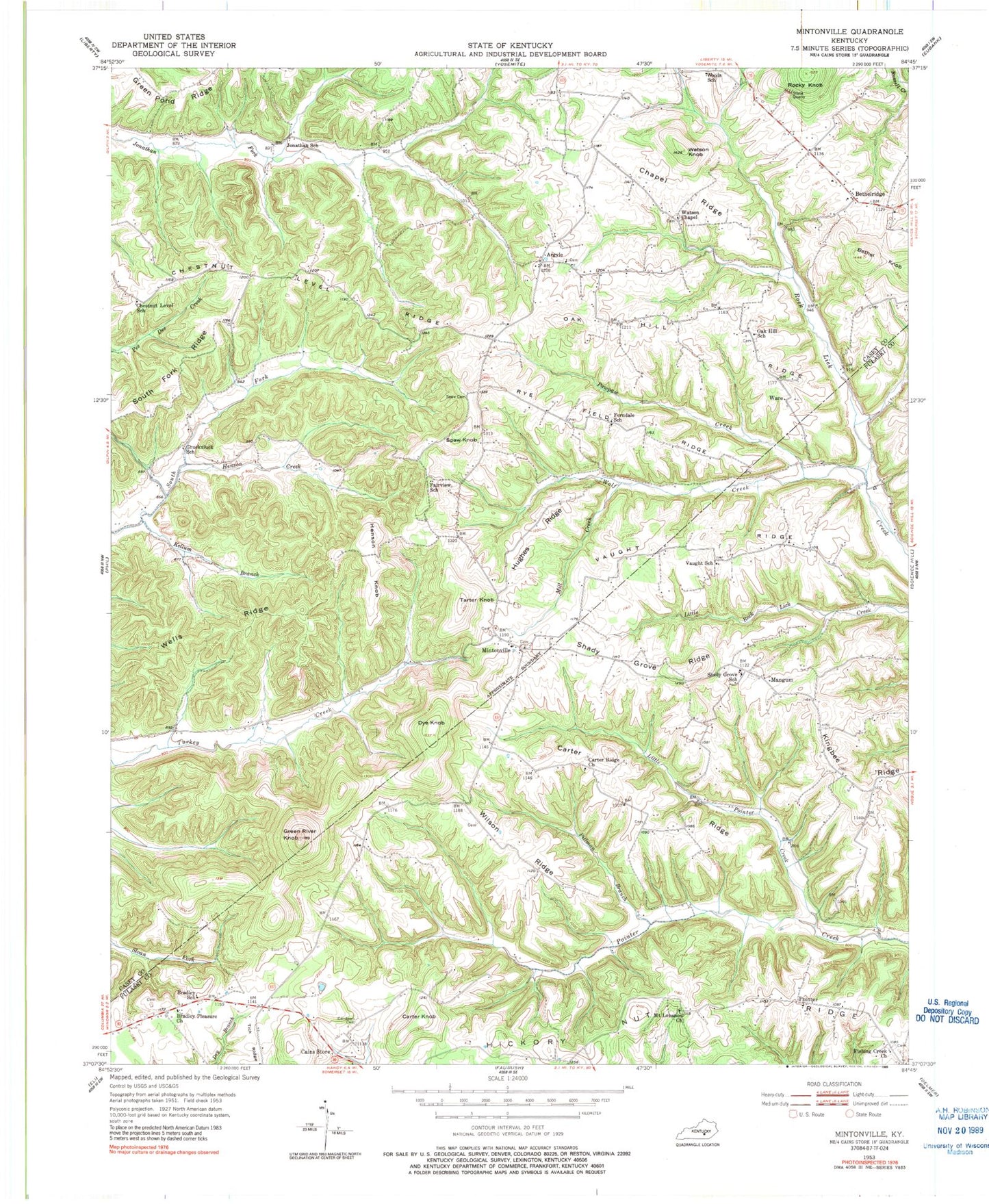
Classic USGS Mintonville Kentucky 7.5'x7.5' Topo Map
Couldn't load pickup availability
Historical USGS topographic quad map of Mintonville in the state of Kentucky. Map scale may vary for some years, but is generally around 1:24,000. Print size is approximately 24" x 27"
This quadrangle is in the following counties: Casey, Pulaski.
The map contains contour lines, roads, rivers, towns, and lakes. Printed on high-quality waterproof paper with UV fade-resistant inks, and shipped rolled.
Contains the following named places: Argyle, Argyle Post Office, Bethel Knob, Bethelridge, Bethelridge Cemetery, Bethelridge School, Bradley Pleasure Church, Bradley School, Bright Post Office, Cains Store, Caintown Cemetery, Carter Knob, Carter Ridge, Carter Ridge Church, Chapel Ridge, Chestnut Level Ridge, Chestnut Level School, Chuck Post Office, Chuckuluck School, Dye Knob, Fairview School, Ferndale, Ferndale Church, Ferndale School, Fishing Creek Church, Grave Hill Cemetery, Green River Knob, Henson Creek, Henson Knob, Hickory Nut Ridge, Hughes Ridge, Jonathan School, Joyce Post Office, Kellum Branch, Little Pointer Creek, Mangum, Mill Creek, Mintonville, Mintonville Cemetery, Mintonville Post Office, Mintonville School, Mount Lebanon Church, Oak Hill Cemetery, Oak Hill Ridge, Oak Hill School, Pawpaw Creek, Phelps Cemetery, Pittman Branch, Pointer, Roberts Cemetery, Rocky Knob, Rye Field Ridge, Shady Grove Ridge, Shady Grove School, Spaw Cemetery, Spaw Knob, Tarter Knob, Tick Ridge, Valley Oak Cemetery, Valley Oak School, Valley Oaks United Baptist Church, Vaught Ridge, Vaught School, Ware, Ware Post Office, Watson Chapel Cemetery, Watson Chapel Christian Church, Watson Knob, Wells Ridge, Wilson Ridge, WKSO-TV (Somerset), Wolf Creek, Woods School, ZIP Code: 42516