MyTopo
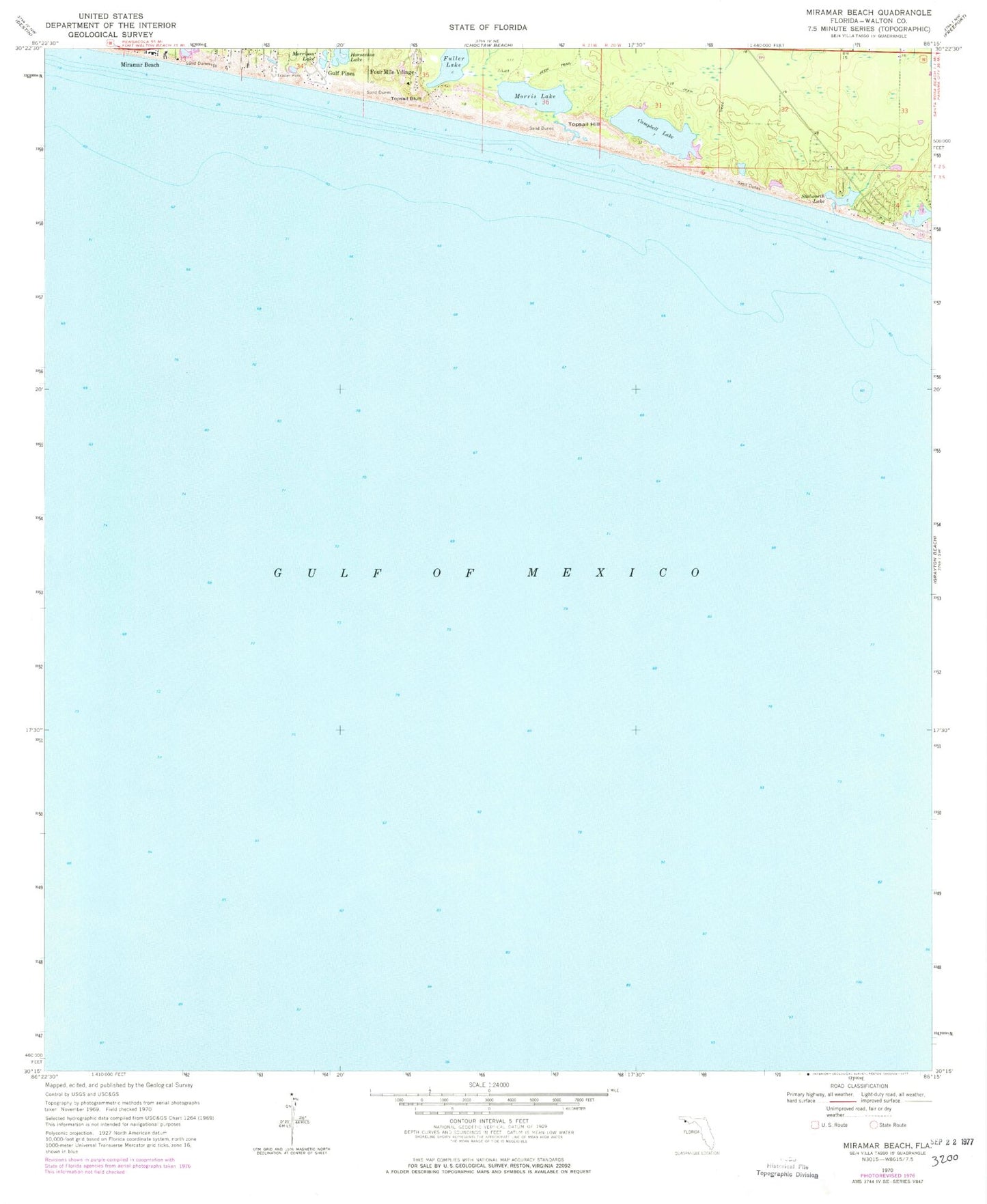
Classic USGS Miramar Beach Florida 7.5'x7.5' Topo Map
Regular price
$16.95
Regular price
Sale price
$16.95
Unit price
per
Couldn't load pickup availability
Historical USGS topographic quad map of Miramar Beach in the state of Florida. Map scale may vary for some years, but is generally around 1:24,000. Print size is approximately 24" x 27"
This quadrangle is in the following counties: Walton.
The map contains contour lines, roads, rivers, towns, and lakes. Printed on high-quality waterproof paper with UV fade-resistant inks, and shipped rolled.
Contains the following named places: Campbell Lake, Crystal Spring, Four Mile Village, Fuller Lake, Gulf Pines, Horseshoe Lake, Miramar Beach, Morris Lake, Morrison Lake, Peace Pond, Stalworth Lake, Tang-O-Mar Beach, Topsail Bluff, Topsail Hill, Topsail Hill Preserve State Park, Van R Butler Elementary School