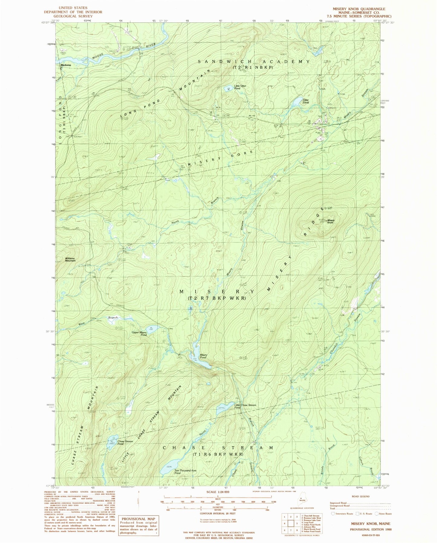
MyTopo
Classic USGS Misery Knob Maine 7.5'x7.5' Topo Map
Couldn't load pickup availability
Historical USGS topographic quad map of Misery Knob in the state of Maine. Map scale may vary for some years, but is generally around 1:24,000. Print size is approximately 24" x 27"
This quadrangle is in the following counties: Somerset.
The map contains contour lines, roads, rivers, towns, and lakes. Printed on high-quality waterproof paper with UV fade-resistant inks, and shipped rolled.
Contains the following named places: Chase Stream Mountain, Chase Stream Pond, Lanigan Dam, Little Chase Stream Mountain, Little Chase Stream Pond, Little Otter Pond, Long Pond Dam, Long Pond Mountain, Milliken Farm, Misery Knob, Misery Pond, Misery Ridge, Misery Township, North Branch Chase Stream, North Branch Misery Stream, Otter Pond, Sandwich Academy Grant Township, Somerset County, Ten Thousand Acre Pond, Trout Brook, Upper Misery Pond, West Branch Misery Stream