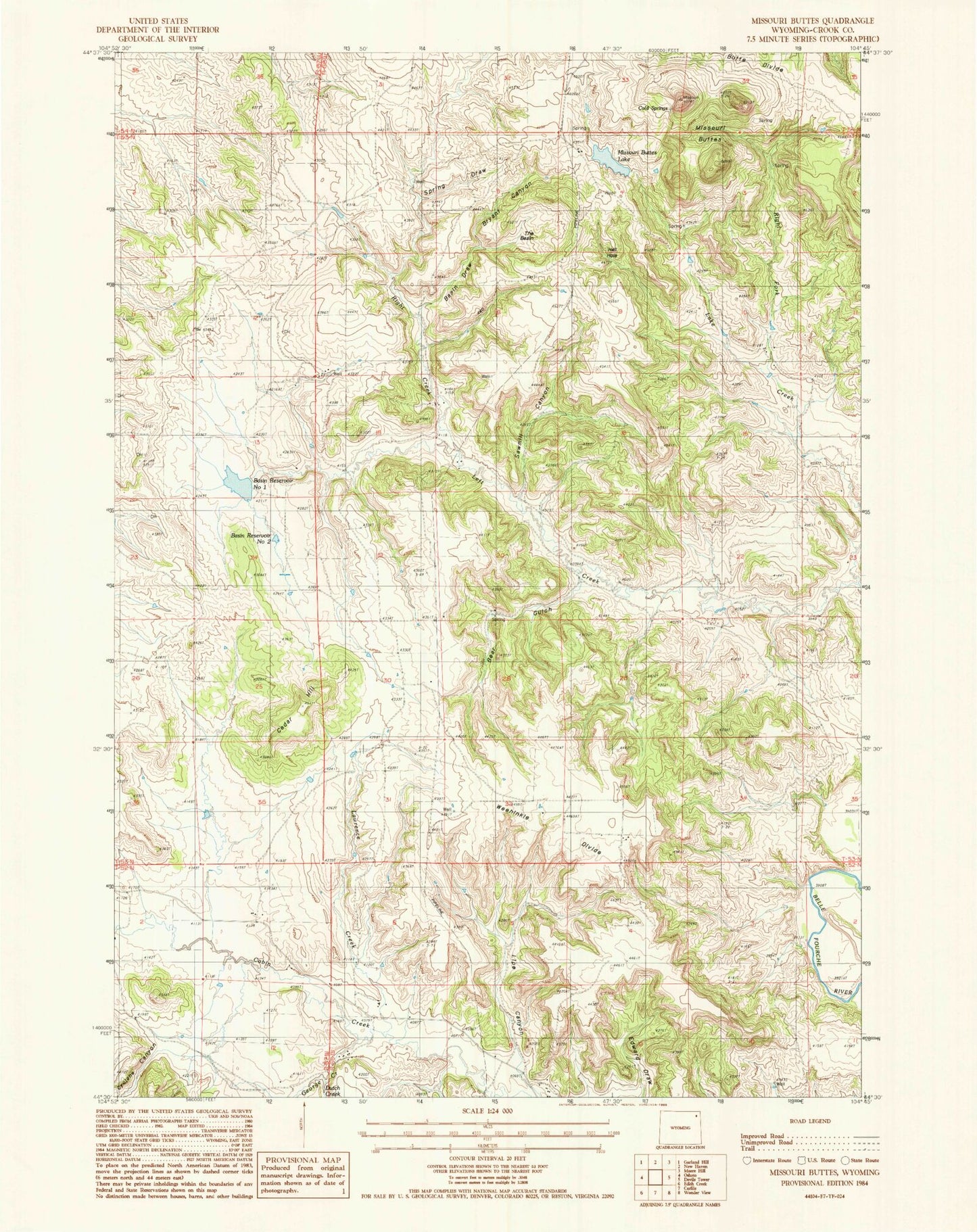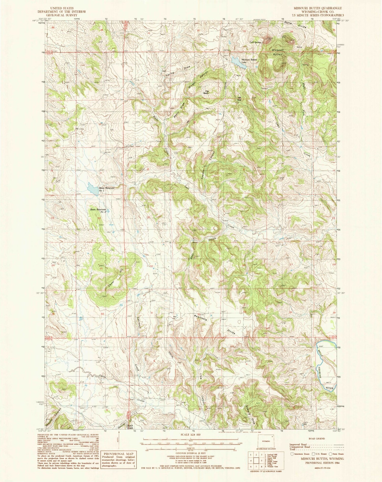
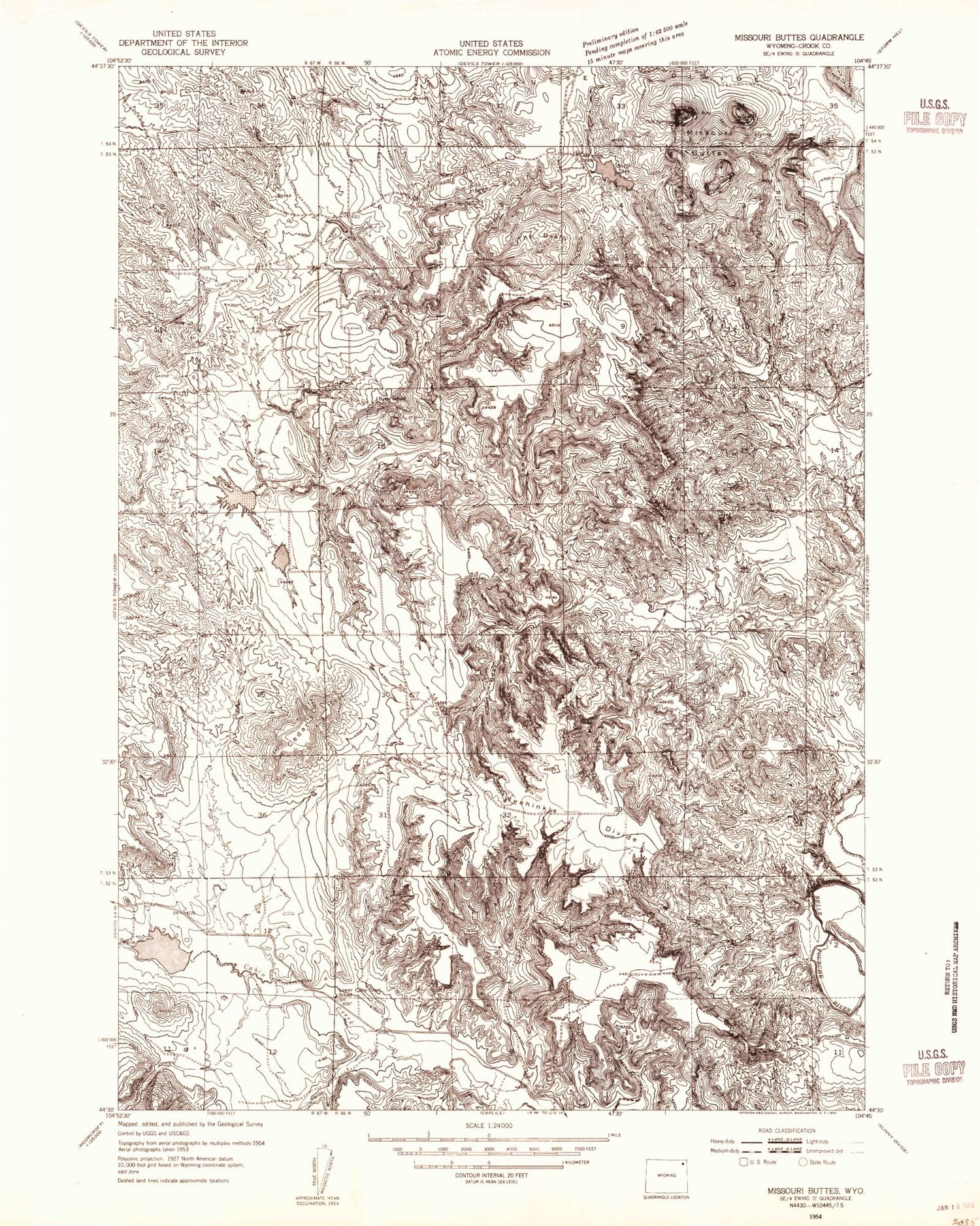
MyTopo
Classic USGS Missouri Buttes Wyoming 7.5'x7.5' Topo Map
Couldn't load pickup availability
Historical USGS topographic quad map of Missouri Buttes in the state of Wyoming. Map scale may vary for some years, but is generally around 1:24,000. Print size is approximately 24" x 27"
This quadrangle is in the following counties: Crook.
The map contains contour lines, roads, rivers, towns, and lakes. Printed on high-quality waterproof paper with UV fade-resistant inks, and shipped rolled.
Contains the following named places: Basin Draw, Basin Number 1 Dam, Basin Number 2 Dam, Basin Reservoir Number One, Basin Reservoir Number Two, Bear Gulch, Bryant Canyon, Butte School, Cedar Hill, Cyclone Canyon, Dutch Creek, Edward Draw, George Creek, Hell Hole, Lake Creek, Lake Ranch School, Lawrence Creek, Lipe Canyon, Lower Cabin Creek School, Missouri Buttes, Missouri Buttes Lake, Red Rock One Mine, Red Rock Two Mine, Right Creek, Right Fork Lake Creek, Sand Lode Four, Sawmill Canyon, Spring Draw, The Basin, Weehinkle Divide