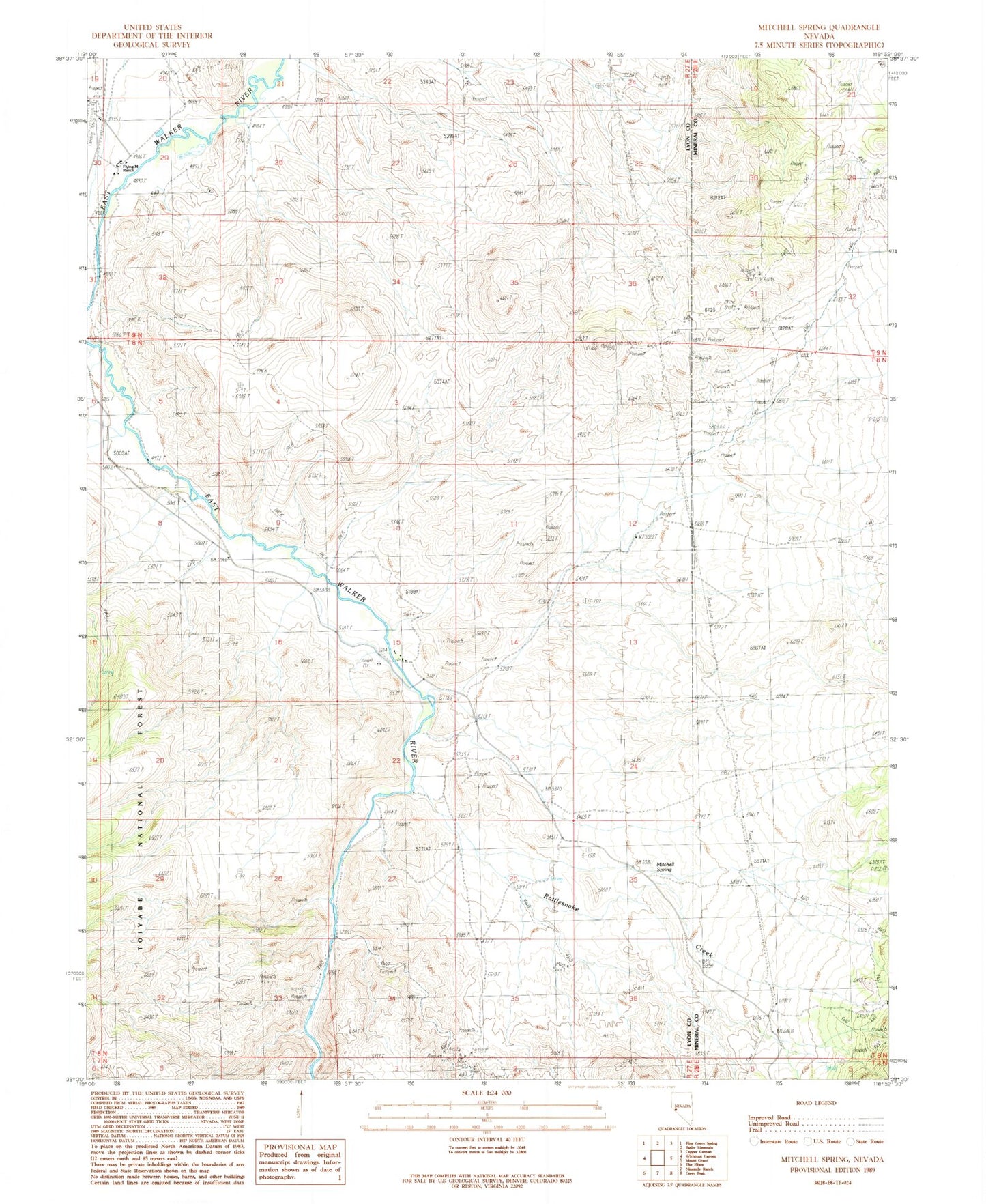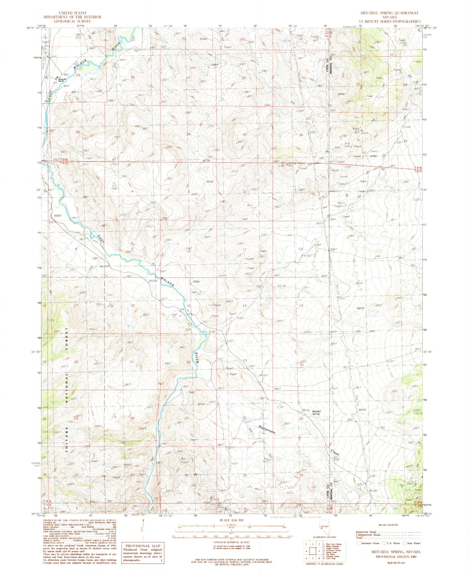
MyTopo
Classic USGS Mitchell Spring Nevada 7.5'x7.5' Topo Map
Regular price
$16.95
Regular price
Sale price
$16.95
Unit price
per
Couldn't load pickup availability
Historical USGS topographic quad map of Mitchell Spring in the state of Nevada. Map scale may vary for some years, but is generally around 1:24,000. Print size is approximately 24" x 27"
This quadrangle is in the following counties: Lyon, Mineral.
The map contains contour lines, roads, rivers, towns, and lakes. Printed on high-quality waterproof paper with UV fade-resistant inks, and shipped rolled.
Contains the following named places: Coal Valley, Cottonwood Creek, Dickey Spring, East Walker School, Flying M Ranch, Lapham Canyon, Lapham Creek, Lewis Coal Mine, Mitchell Spring, Morgans Ranch, Rattlesnake Creek, Washington, Washington Post Office, Wichman, Wichman Post Office