MyTopo
Classic USGS Mitchell Indiana 7.5'x7.5' Topo Map
Couldn't load pickup availability
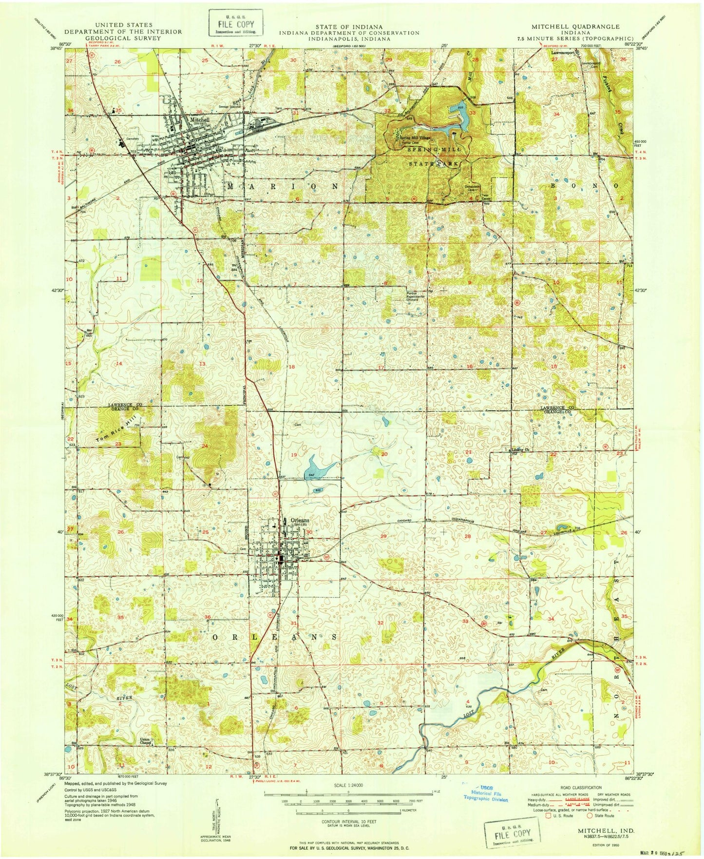
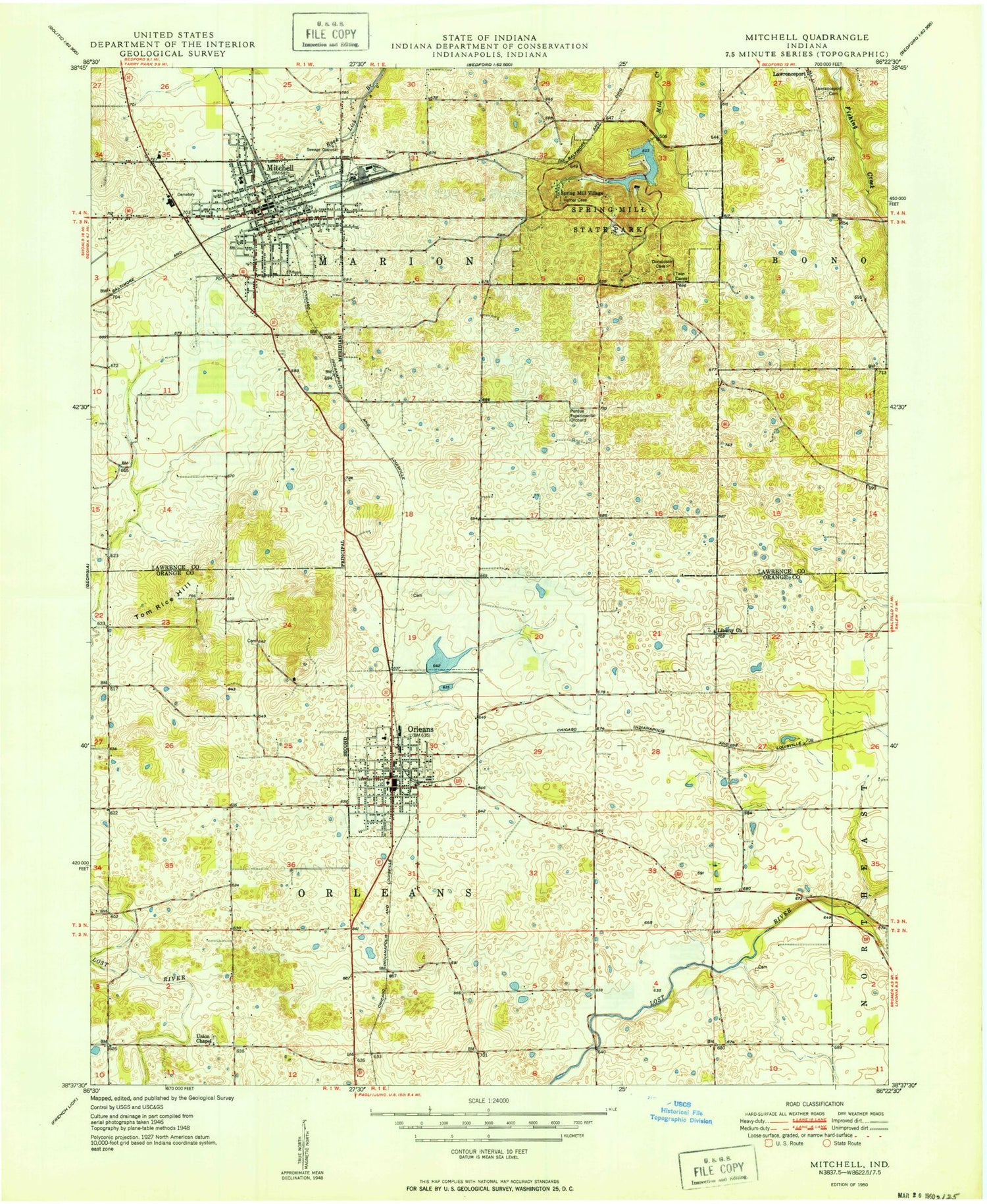
Historical USGS topographic quad map of Mitchell in the state of Indiana. Map scale may vary for some years, but is generally around 1:24,000. Print size is approximately 24" x 27"
This quadrangle is in the following counties: Lawrence, Orange.
The map contains contour lines, roads, rivers, towns, and lakes. Printed on high-quality waterproof paper with UV fade-resistant inks, and shipped rolled.
Contains the following named places: Arnold Creek, Burris Elementary School, City of Mitchell, Crandall Farms, Fairview Cemetery, First Baptist Church of Orleans, Freedom Cemetery, Hamer Cemetery, Holiday Drive-In, Liberty Church, Marion Township Rural Fire Department, Mitchell, Mitchell Fire Department Station 1, Mitchell Fire Department Station 2, Mitchell High School, Mitchell Police Department, Mitchell Post Office, Mount Carmel Church, Mount Hebron Church, Old Cemetery, Orange County House of Prayer, Orange County Rural Volunteer Fire Department District 2, Orleans, Orleans Airport, Orleans Elementary School, Orleans Junior Senior High School, Orleans Police Department, Orleans Post Office, Orleans Quarry, Orleans Springs, Orleans United Methodist Church, Orleans Volunteer Fire Department, Orleans Water Works Reservoir, Orleans Water Works Reservoir Dam, Pilgrim Campground, Purdue Experimental Orchard, River View Farms, Small Drain, Spring Mall Park Lake, Spring Mall Park Lake Dam, Spring Mill State Park, Spring Mill Village, Tom Rice Hill, Town of Orleans, Township of Marion, Township of Orleans, Union Chapel, Water Run, ZIP Code: 47452