MyTopo
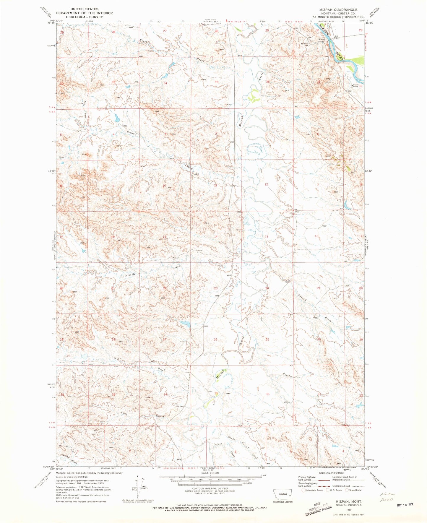
Classic USGS Mizpah Montana 7.5'x7.5' Topo Map
Couldn't load pickup availability
Historical USGS topographic quad map of Mizpah in the state of Montana. Map scale may vary for some years, but is generally around 1:24,000. Print size is approximately 24" x 27"
This quadrangle is in the following counties: Custer.
The map contains contour lines, roads, rivers, towns, and lakes. Printed on high-quality waterproof paper with UV fade-resistant inks, and shipped rolled.
Contains the following named places: 04N53E04BCB_01 Well, 05N51E01CDBD01 Well, 05N51E12BC__01 Well, 05N51E29DDDC01 Well, 05N52E18BBBB01 Well, 05N52E20BCCC01 Well, 05N52E30AD__01 Well, 06N52E29CCDD01 Well, 06N52E30ADCB01 Well, 06N52E30ADCC01 Well, 06N52E30CD__01 Well, Balsam Ranch, Corral Creek, Double Corral Creek, Fessler Creek, First Creek, Fivemile Creek, Hells Gulch, J Hardy Number 1 Dam, J Hardy Number 2 Dam, M S Creek, Mizpah, Mizpah Post Office, Powder River Bridge, Riverview School, Russell Creek, Second Creek