
MyTopo
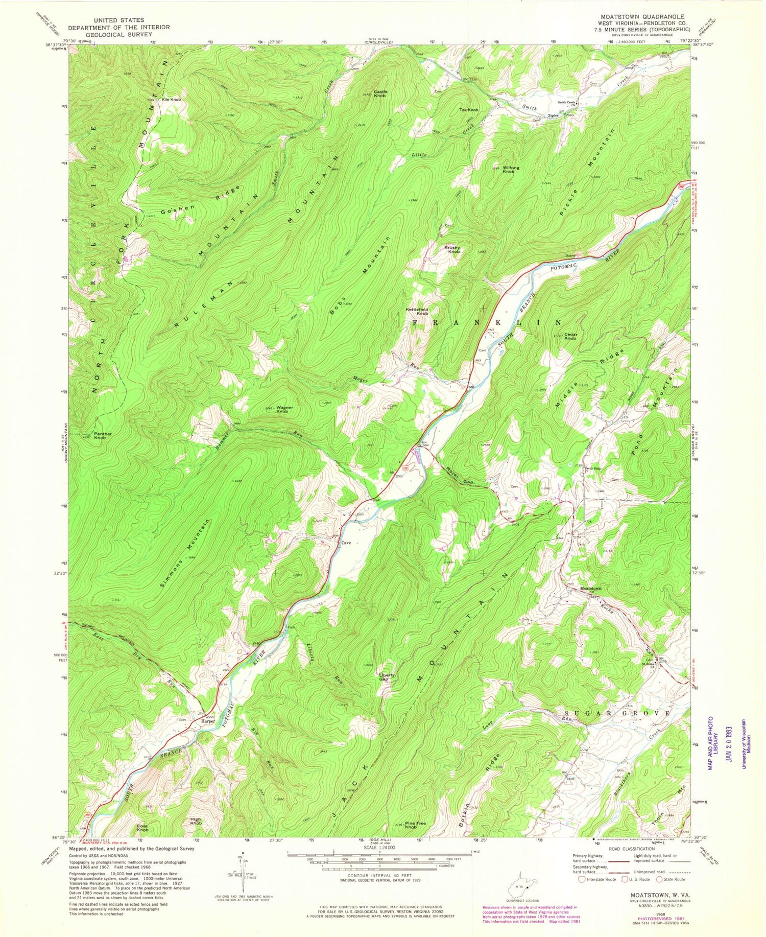
Classic USGS Moatstown West Virginia 7.5'x7.5' Topo Map
Couldn't load pickup availability
Historical USGS topographic quad map of Moatstown in the state of West Virginia. Map scale may vary for some years, but is generally around 1:24,000. Print size is approximately 24" x 27"
This quadrangle is in the following counties: Pendleton.
The map contains contour lines, roads, rivers, towns, and lakes. Printed on high-quality waterproof paper with UV fade-resistant inks, and shipped rolled.
Contains the following named places: Big Run, Bobs Mountain, Brushy Knob, Castle Knob, Cave, Cedar Knob, Central District, Cove Knob, East Dry Run, Goshen Ridge, Gravel Lick Run, Hammer Run, Hammer Run Spring, Harper, High Knob, Kettlefield Knob, Kile Knob, Liberty Gap, Liberty Run, Little Creek, Long Run, Middle Ridge, Moatstown, Moyer Farm Spring, Moyer Gap, Moyer Run, North Fork Mountain, Panther Knob, Pickle Mountain, Pine Tree Knob, Pond Mountain, Rexrode Farm Spring, Ruleman Mountain, Saint Johns Church, Sandy Ridge Church, Sennett Farm Spring, Simmons Mountain, Smith Creek Church, Tea Knob, Wagner Knob, Wilfong Knob, Zigler


