MyTopo
Classic USGS Moddersville Michigan 7.5'x7.5' Topo Map
Couldn't load pickup availability
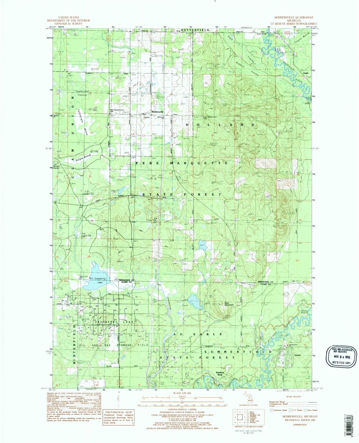
Historical USGS topographic quad map of Moddersville in the state of Michigan. Map scale may vary for some years, but is generally around 1:24,000. Print size is approximately 24" x 27"
This quadrangle is in the following counties: Clare, Missaukee.
The map contains contour lines, roads, rivers, towns, and lakes. Printed on high-quality waterproof paper with UV fade-resistant inks, and shipped rolled.
Contains the following named places: Blue Mountain, Community Church, Cranberry Lake, Cranberry Lake Oil and Gas Storage Field, Dolph, Dolph Bridge, Dolph Post Office, East Moddersville Cemetery, Leota, Leota Mall, Leota Post Office, Lone Bridge, Modders Swamp, Moddersville, Moddersville Lookout Tower, Moddersville Post Office, Rainbow Bend, Ralyea Marsh, Reformed Church, Rush Swamp, Sandy Bayou, Spitzbergen Marsh, Township of Holland, Vanderwat Swamp, Warner Bayou, West Moddersville Cemetery, ZIP Code: 49632