MyTopo
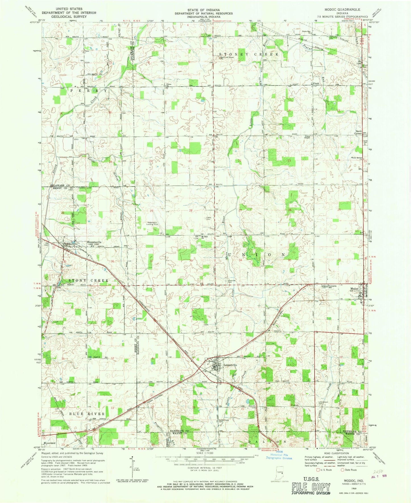
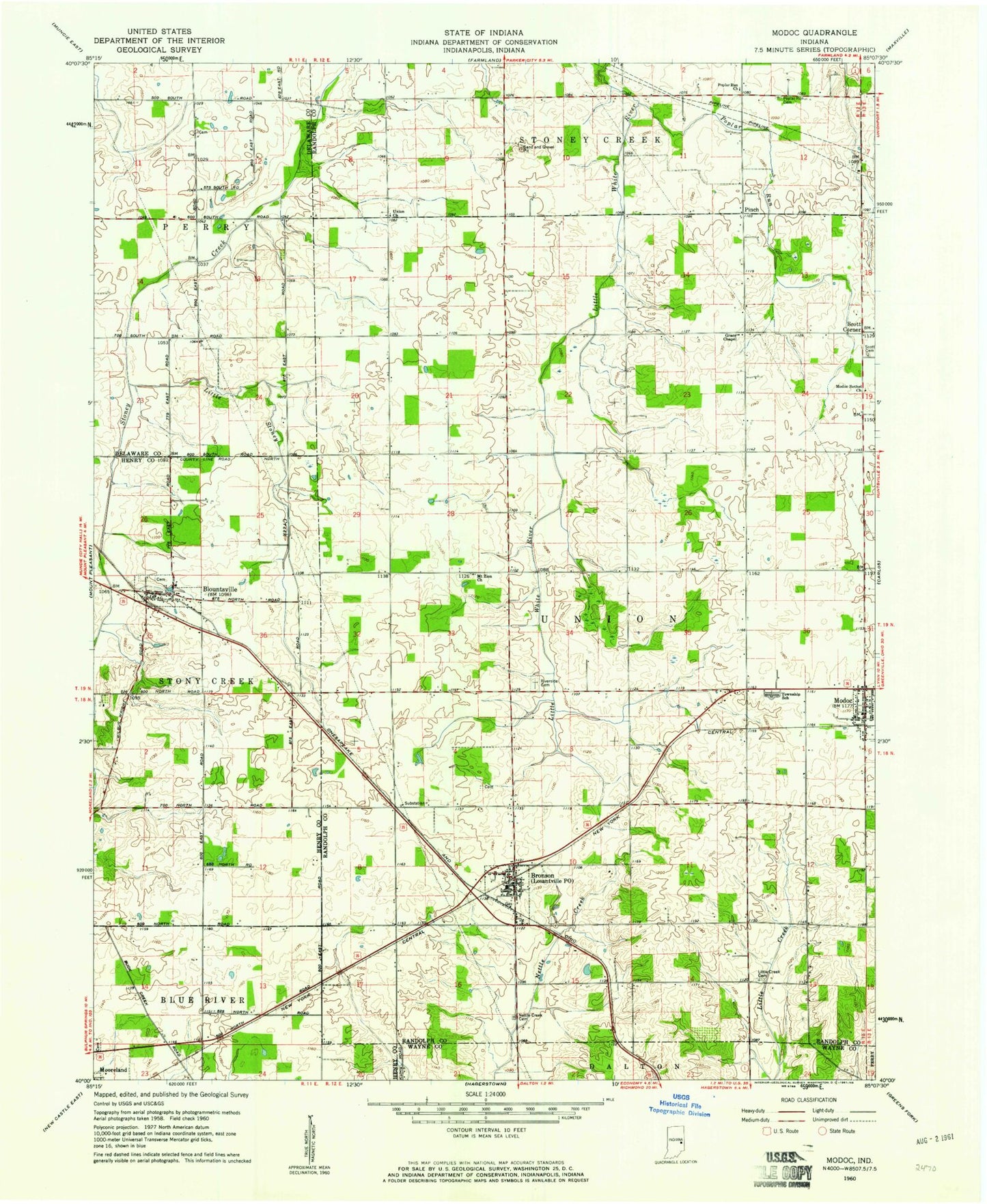
Classic USGS Modoc Indiana 7.5'x7.5' Topo Map
Couldn't load pickup availability
Historical USGS topographic quad map of Modoc in the state of Indiana. Map scale may vary for some years, but is generally around 1:24,000. Print size is approximately 24" x 27"
This quadrangle is in the following counties: Delaware, Henry, Randolph, Wayne.
The map contains contour lines, roads, rivers, towns, and lakes. Printed on high-quality waterproof paper with UV fade-resistant inks, and shipped rolled.
Contains the following named places: Blountsville, Blountsville - Stoney Creek Township Volunteer Fire Department, Burrow Farms, Cabin Creek Cemetery, Conningham Ditch, Gable Cemetery, Grace Chapel, Harris Farms, Howell Farms, Lamb Ditch, Lester Farms, Little Creek Cemetery, Little Stoney Creek, Losantville, Losantville Post Office, McCormick Farms, Modoc, Modoc Bethel Church, Modoc Fire Department, Modoc Post Office, Mount Zion Church, Nettle Creek Baptist Cemetery, Nettle Creek Township, Pinch, Pool Hog Farms, Poplar Run, Poplar Run Cemetery, Poplar Run Church, Riverside Cemetery, Scott Cemetery, Scott Corner, Stoney Creek Township Fire Department, Sunny Meadows, Town of Blountsville, Town of Losantville, Town of Modoc, Union Church, Union Elementary School, Union Junior and High School, West Union Fire Department, ZIP Code: 47354