MyTopo
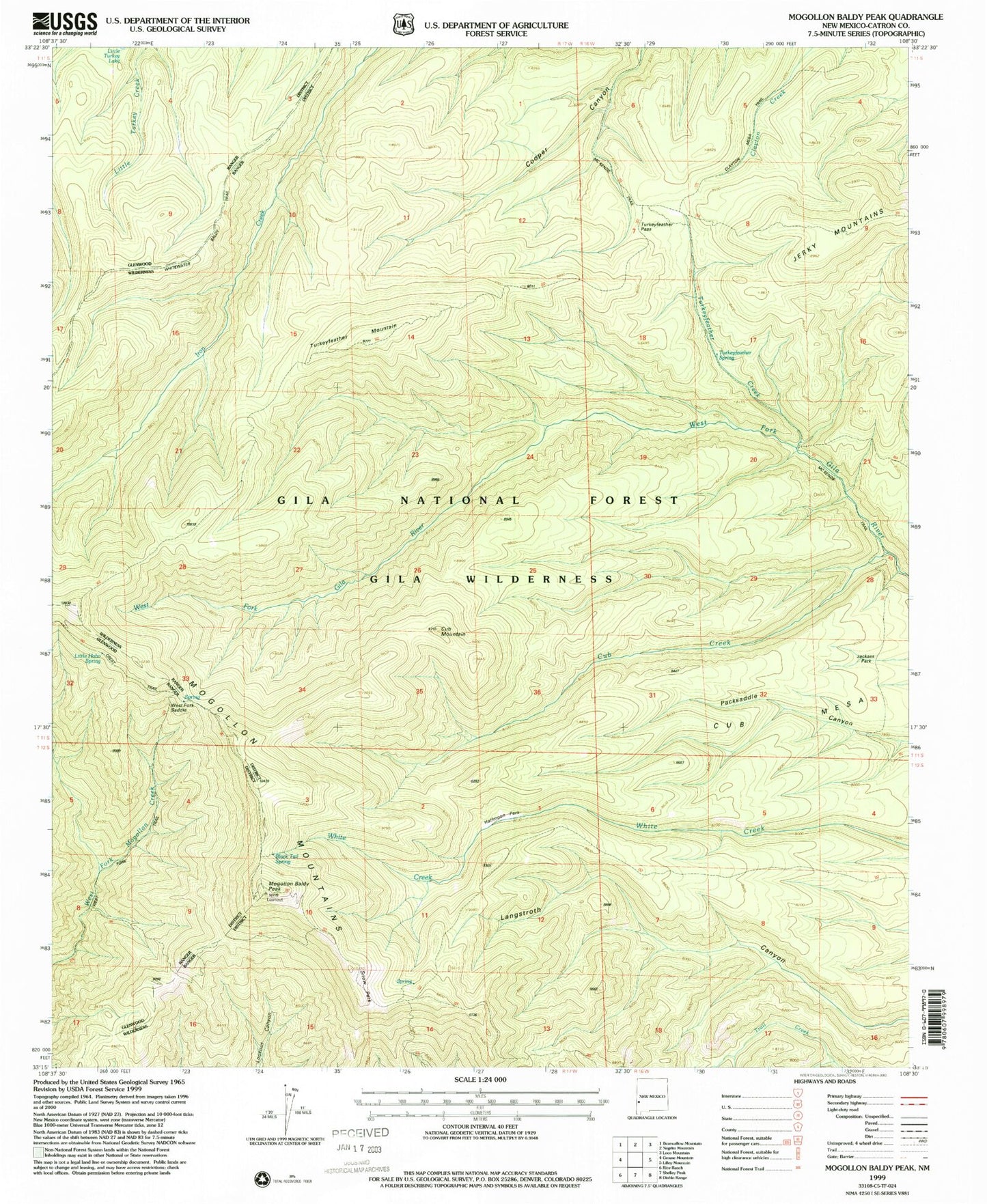
USGS Classic Mogollon Baldy Peak New Mexico 7.5'x7.5' Topo Map
Couldn't load pickup availability
Historical USGS topographic quad map of Mogollon Baldy Peak in the state of New Mexico. Scale: 1:24000. Print size: 24" x 27"
This quadrangle is in the following counties: Catron.
The map contains contour lines, roads, rivers, towns, lakes, and grids including latitude / longitude and UTM / MGRS. Printed on high-quality waterproof paper with UV fade-resistant inks.
Contains the following named places: Black Tail Spring, Crest Trail, Cub Creek, Cub Mesa, Cub Mountain, Halfmoon Park, Jackass Park, Little Hobo Spring, McKenzie Trail, Snow Park, Turkeyfeather Creek, Turkeyfeather Mountain, Turkeyfeather Spring, West Fork Corral, West Fork Saddle, Whitewater Baldy Trail, Turkeyfeather Pass, Mogollon Baldy Lookout, Mogollon Baldy Peak