MyTopo
Classic USGS Mohawk Tennessee 7.5'x7.5' Topo Map
Couldn't load pickup availability
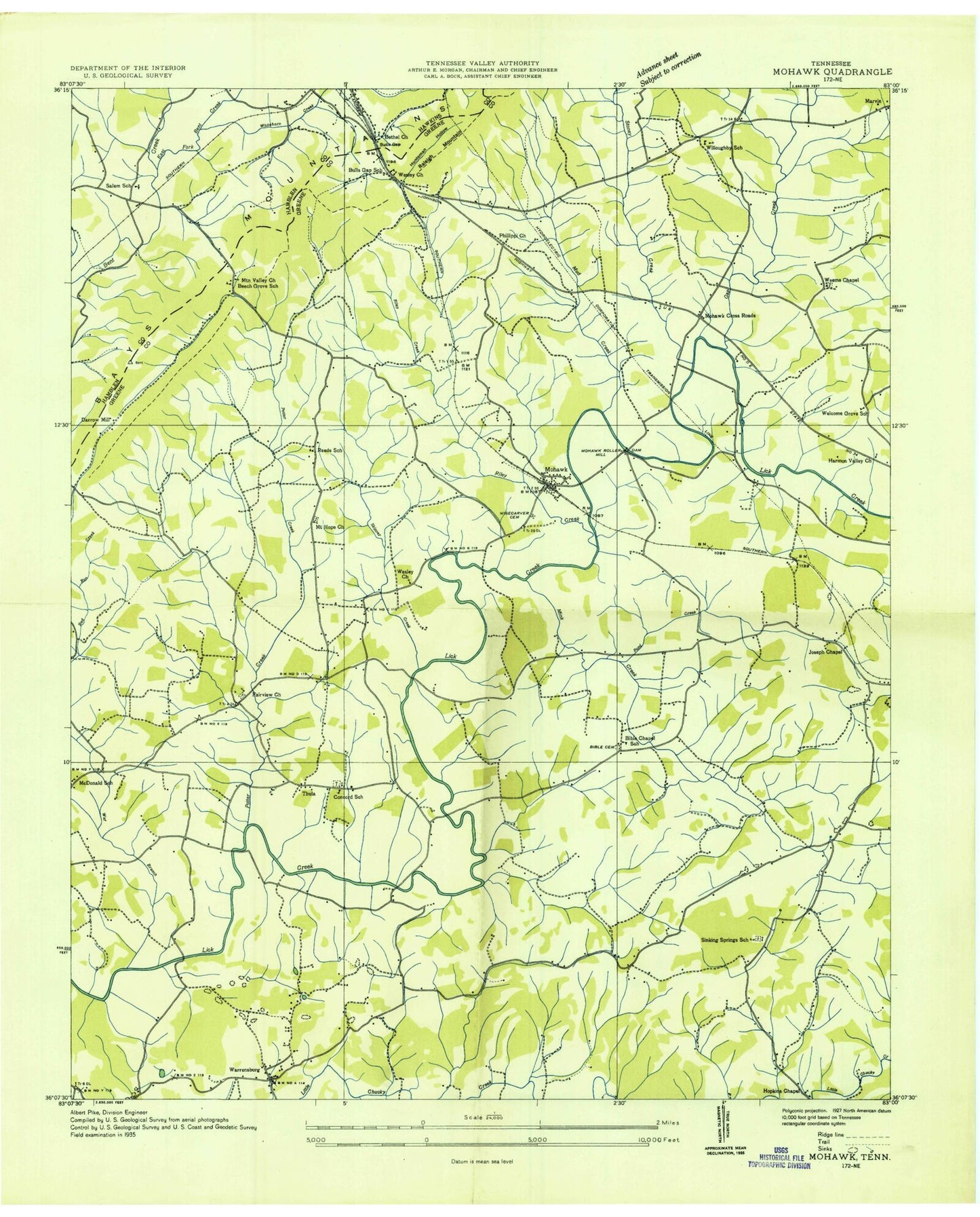
Historical USGS topographic quad map of Mohawk in the state of Tennessee. Map scale may vary for some years, but is generally around 1:24,000. Print size is approximately 24" x 27"
This quadrangle is in the following counties: Greene, Hamblen, Hawkins.
The map contains contour lines, roads, rivers, towns, and lakes. Printed on high-quality waterproof paper with UV fade-resistant inks, and shipped rolled.
Contains the following named places: Beech Grove School, Bethel Church, Bible Cemetery, Bible Chapel, Bible Chapel School, Bird Hill, Black Creek, Bulls Gap, Bulls Gap School, Campbell Mountain, Commissioner District 6, Concord Church, Crosby Cemetery, Darrow Hollow, Darrow Mill, Drake Cemetery, Easterly Pond, Fairview Church, Fox Branch, Gap Creek, Gray Branch, Harmon Valley Church, Hopkins Chapel, Huntsman Hollow, Joseph Chapel, Lotspeachy Mill, Lyons Creek, McDonald Elementary School, Midway Spring, Midway Volunteer Fire Department, Mink Creek, Mohawk, Mohawk Crossroad, Mohawk Division, Mohawk Post Office, Mohawk Roller Mill, Mohawk School, Mount Hope Church, Mountain Valley Church, Mud Creek, Phillippi Church, Pond Creek, Potter Creek, Raleigh Mountain, Reeds School, Riley Creek, Salem School, Scruggs Pond, Scruggs Spring, Seven Springs Branch, Sinking Springs Church, Sinking Springs School, Skinner Crossroad, Skipper Creek, Stony Creek, Taylor Gap, Thula, War Branch, Warrensburg, Warrensburg Baptist Church, Warrensburg School, Warrensburg United Methodist Church, Weems Chapel, Welcome Grove School, Wesley Church, Wesley Churh, Whitehorn Creek, Willoughbys School, Wisecarver Cemetery, Wolf Creek, Wright Cemetery, ZIP Codes: 37809, 37810


