MyTopo
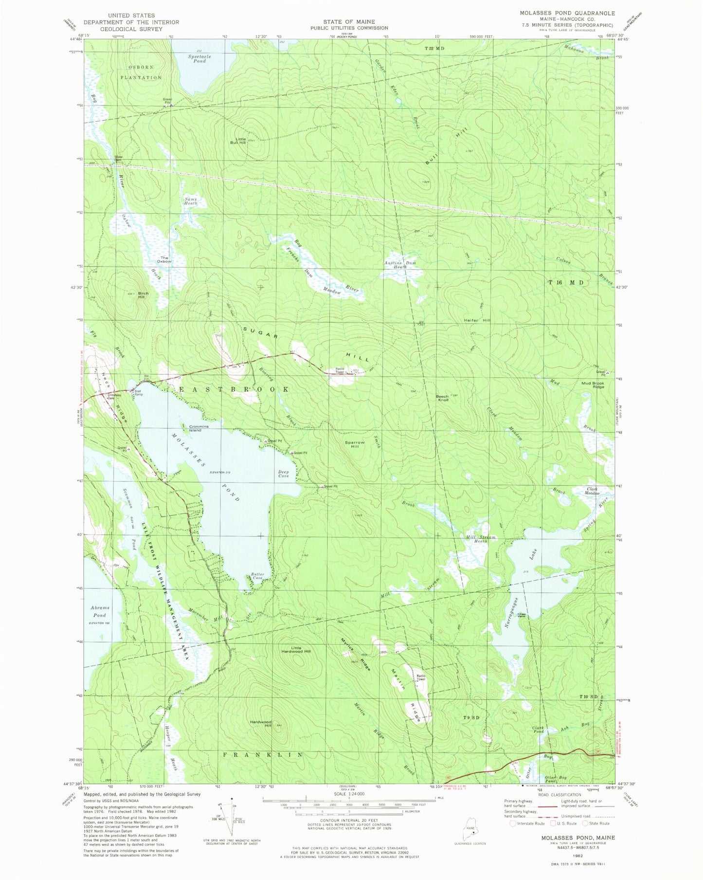
Classic USGS Molasses Pond Maine 7.5'x7.5' Topo Map
Couldn't load pickup availability
Historical USGS topographic quad map of Molasses Pond in the state of Maine. Map scale may vary for some years, but is generally around 1:24,000. Print size is approximately 24" x 27"
This quadrangle is in the following counties: Hancock.
The map contains contour lines, roads, rivers, towns, and lakes. Printed on high-quality waterproof paper with UV fade-resistant inks, and shipped rolled.
Contains the following named places: Abrams Pond, Austins Dam Heath, Beech Knoll, Birch Hill, Bull Hill, Butler Cove, Chez Vent, Clark Meadow, Clark Meadow Brook, Clark Pond, Crimmins Cemetery, Crimmins Island, Deep Cove, Frenchs Dam Meadow, Hardwood Hill, Heifer Hill, Hooper Heath, Little Bull Hill, Little Hardwood Hill, Lyle Frost Wildlife Management Area, Macomber Mill Stream, Martin Ridge, Mill Stream Heath, Molasses Pond, Molasses Pond Boat Launch, Mud Brook Ridge, Myrick Ridge, Narraguagus Lake, Neck Ridge, Otter Bog, Oxbow Heath, Roaring Brook, Sams Heath, Scammon Pond, Sparrow Hill, Sugar Hill, The Oxbow, Town of Eastbrook, ZIP Code: 04634