MyTopo
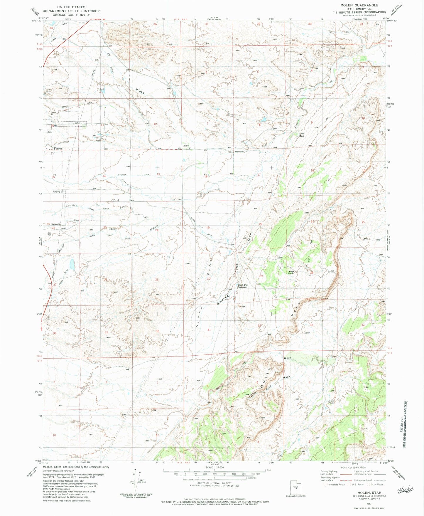
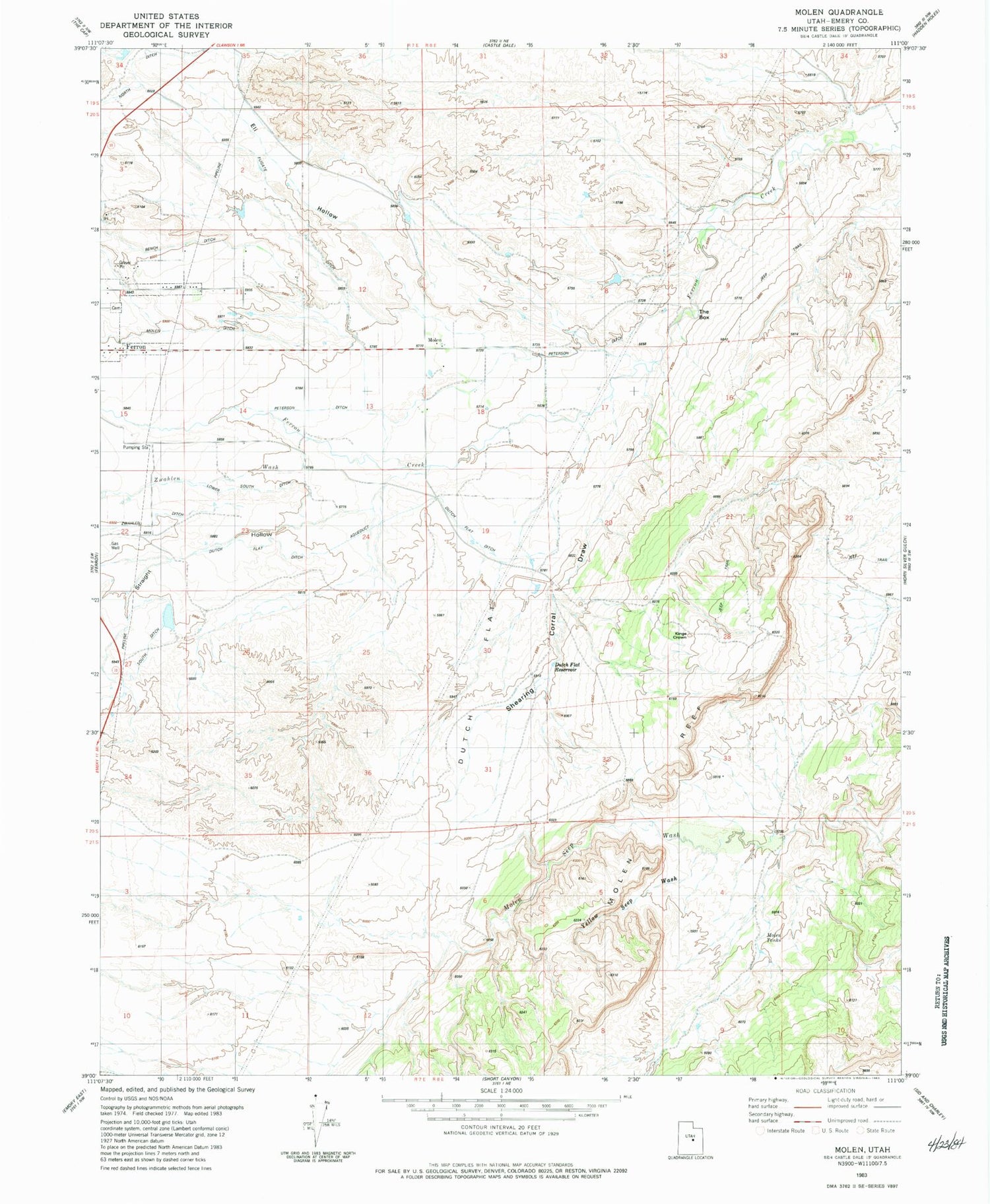
Classic USGS Molen Utah 7.5'x7.5' Topo Map
Couldn't load pickup availability
Historical USGS topographic quad map of Molen in the state of Utah. Map scale may vary for some years, but is generally around 1:24,000. Print size is approximately 24" x 27"
This quadrangle is in the following counties: Emery.
The map contains contour lines, roads, rivers, towns, and lakes. Printed on high-quality waterproof paper with UV fade-resistant inks, and shipped rolled.
Contains the following named places: Bench Ditch, Blue Dougway, Dutch Flat, Dutch Flat Ditch, Dutch Flat Reservoir, Eli Hollow, Ferron City Cemetery, Fugate Ditch, Kings Crown, Larson Ranch, Molen, Molen Cemetery, Molen Ditch, Molen Tanks, Nelson Ranch, Paradise Ranch, Peterson Ditch, Shearing Corral Draw, Straight Hollow, The Box, Yellow Seep Wash, Zwahlen Ditch