MyTopo
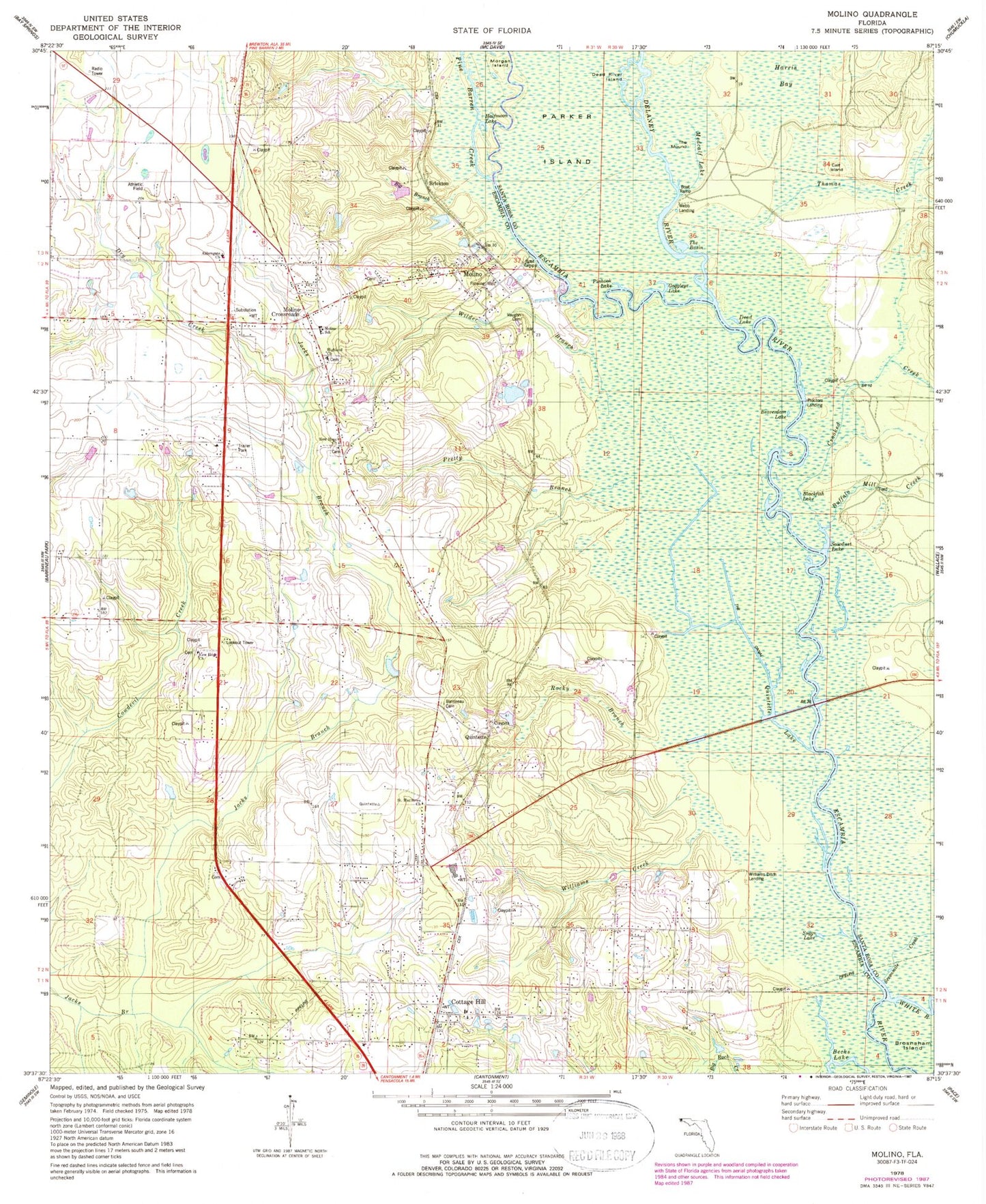
Classic USGS Molino Florida 7.5'x7.5' Topo Map
Couldn't load pickup availability
Historical USGS topographic quad map of Molino in the state of Florida. Typical map scale is 1:24,000, but may vary for certain years, if available. Print size: 24" x 27"
This quadrangle is in the following counties: Escambia, Santa Rosa.
The map contains contour lines, roads, rivers, towns, and lakes. Printed on high-quality waterproof paper with UV fade-resistant inks, and shipped rolled.
Contains the following named places: Pine Barren Creek, Aldersgate Church, Barrineau Cemetery, Beaverdam Lake, Becks Lake, Big Branch, Blackfish Lake, Buffalo Mill Creek, Calf Island, Cottage Hill, Crooked Creek, Dead Lake, Dead River Island, Delaney River, Dry Creek, Halfmoon Lake, Harris Bay, Highland Church, Medcalf Lake, Molino, Molino School (historical), Morgan Island, New Hope Church, New Hope Church, Parker Island, Pinhook Lake, Pretty Branch, Quintette Lake, Rocky Branch, Saint Matthews Church, Sawdust Lake, Sevenmile Creek, Suggs Lake, The Mound, Thomas Creek, Vaughn Cemetery, Wilder Branch, Williams Creek, Brickton, Molino Crossroads, Proctors Landing, Quintette, Webb Landing, Williams Ditch Landing, Goggleye Lake, Gargoyle Lake, Stella Railroad Station, Molino Fire Tower, Quintette Bridge, Miguel Hernandez Grant, John De La Rua Grant, Antoine Collins Grant, Nathan Shackleford Grant, Cedartown School, Molino Park Elementary School, Molino Census Designated Place, The Basin, Escambia County Fire and Rescue Station 18, Escambia County Fire and Rescue Station 18, Escambia County Sheriff's Office - Precinct 5 Cantonment / Molino, Molino Post Office