MyTopo
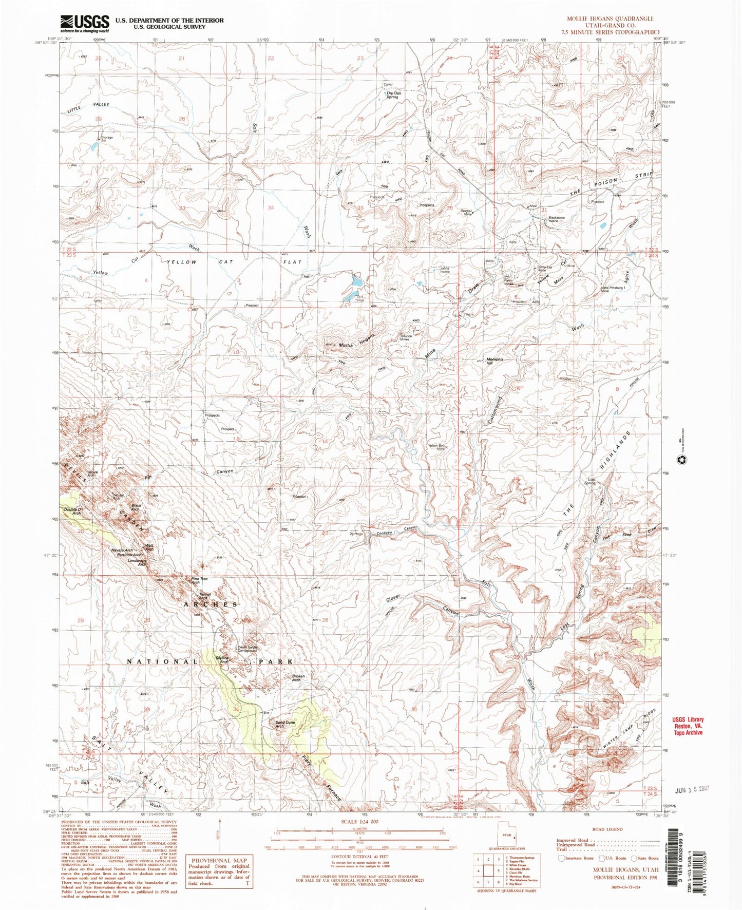
Classic USGS Mollie Hogans Utah 7.5'x7.5' Topo Map
Couldn't load pickup availability
Historical USGS topographic quad map of Mollie Hogans in the state of Utah. Typical map scale is 1:24,000, but may vary for certain years, if available. Print size: 24" x 27"
This quadrangle is in the following counties: Grand.
The map contains contour lines, roads, rivers, towns, and lakes. Printed on high-quality waterproof paper with UV fade-resistant inks, and shipped rolled.
Contains the following named places: Agate Wash, Black Ape Mine, Blackstone Incline, Clover Canyon, Cottonwood Wash, Devils Garden, Double O Arch, Dry Oak Spring, Fiery Furnace, Fin Canyon, Fish Seep Draw, Johns Incline, Landscape Arch, Little Eva Mine, Little Valley, Lost Spring, Lost Spring Canyon, Memphis Hill, Memphis Mines, Mine Draw, Mollie Hogans, Navajo Arch, Parco Mines, Partition Arch, Pine Tree Arch, Ringtail Mine, Skyline Arch, Telluride Mines, Tunnel Arch, Wall Arch (historical), Yellow Bird Mine, Yellow Cat Flat, Yellow Cat Mesa, Yellow Cat Wash, Lemon Airport (historical), Arch de Triumphe, Bat Guano Arch, The Biscuits, Black Cave Arch, Box Arch, Broken Arch, Coke Oven Arch, Crystal Arch, Devils Garden Trailhead, Gothic Arch, Oval Canyon Natural Bridge, Piano Leg Arch, Shadow Box Arch, Tapestry Arch, Turban Head Arch, Sand Dune Arch, Top Story Window, Clover Canyon Bridge, Box Arch, Cordova Canyon