MyTopo
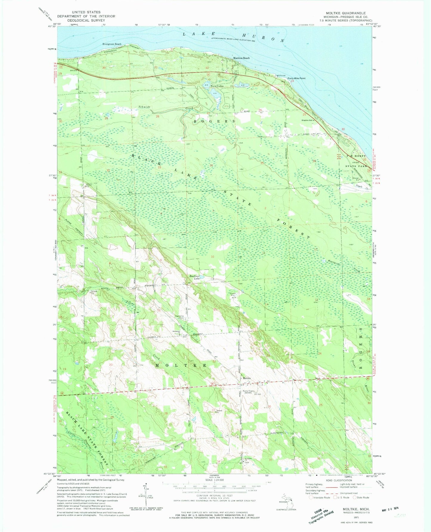
Classic USGS Moltke Michigan 7.5'x7.5' Topo Map
Couldn't load pickup availability
Historical USGS topographic quad map of Moltke in the state of Michigan. Map scale may vary for some years, but is generally around 1:24,000. Print size is approximately 24" x 27"
This quadrangle is in the following counties: Presque Isle.
The map contains contour lines, roads, rivers, towns, and lakes. Printed on high-quality waterproof paper with UV fade-resistant inks, and shipped rolled.
Contains the following named places: Beechnut Lake, Evergreen Beach, Forty Mile Point, Forty Mile Point Light, Immanuel Church, Immanuel Lutheran Cemetery, Kingdom Hall, Manitou Beach, Moltke, Moltke Post Office, Moltke Township Cemetery, P H Hoeft State Park, Saint James Church, Saint James' Lutheran Cemetery, Schmidt Creek, Township of Moltke, Township of Rogers, Twin Lakes, WHAK-AM (Rogers City)