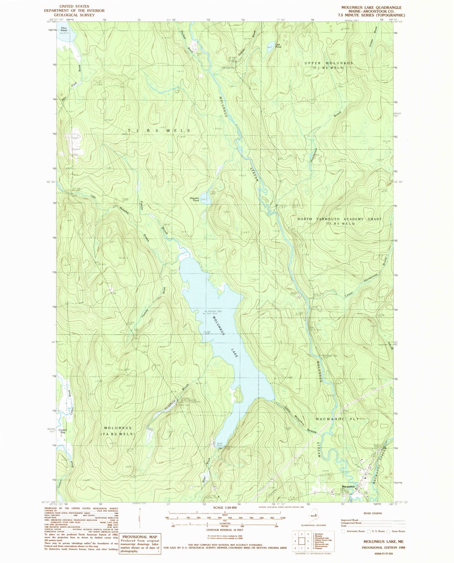
MyTopo
Classic USGS Molunkus Lake Maine 7.5'x7.5' Topo Map
Couldn't load pickup availability
Historical USGS topographic quad map of Molunkus Lake in the state of Maine. Typical map scale is 1:24,000, but may vary for certain years, if available. Print size: 24" x 27"
This quadrangle is in the following counties: Aroostook.
The map contains contour lines, roads, rivers, towns, and lakes. Printed on high-quality waterproof paper with UV fade-resistant inks, and shipped rolled.
Contains the following named places: Baker Brook, Carlton Bog, Fourmile Brook, Fowler Brook, Gulliver Brook, Haywire Pond, Henderson Brook, Little Molunkus Stream, Lost Pond, Lower Henderson Brook, Macwahoc, Macwahoc Stream, Molunkus Lake, Pine Tree Trail, Plunkett Brook, Threemile Brook, T1 R5 WELS, Smith Cemetery, Village Cemetery, Molunkus Township