
MyTopo
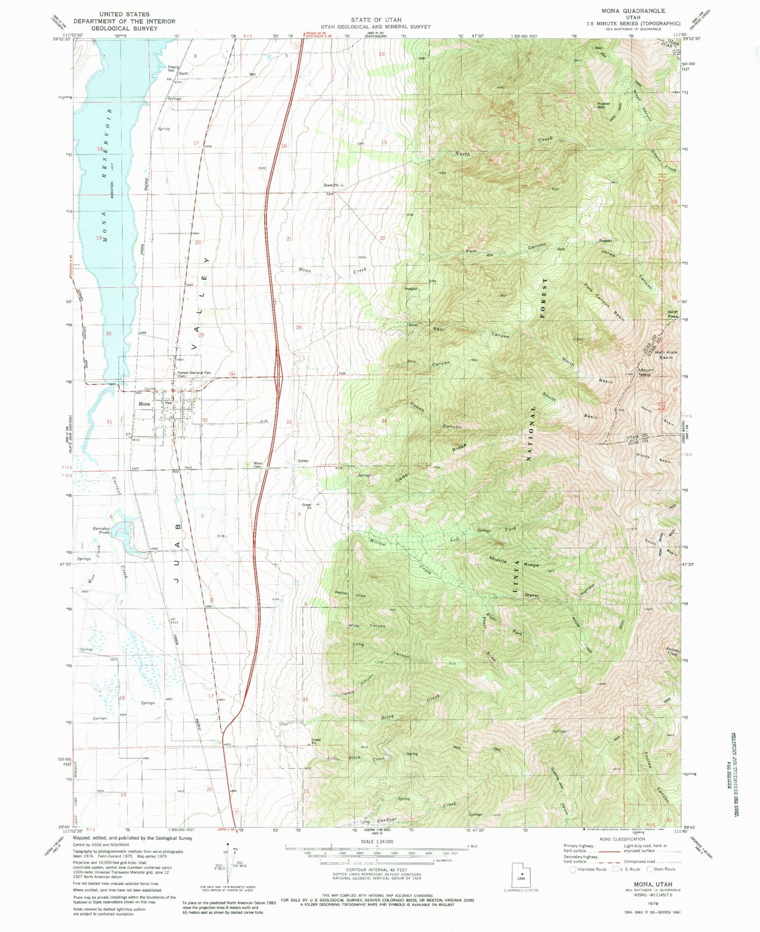
Classic USGS Mona Utah 7.5'x7.5' Topo Map
Couldn't load pickup availability
Historical USGS topographic quad map of Mona in the state of Utah. Map scale may vary for some years, but is generally around 1:24,000. Print size is approximately 24" x 27"
This quadrangle is in the following counties: Juab, Utah.
The map contains contour lines, roads, rivers, towns, and lakes. Printed on high-quality waterproof paper with UV fade-resistant inks, and shipped rolled.
Contains the following named places: Bear Canyon, Birch Creek, Broad Canyon, Burriston Ponds, Cedar Ridge, City of Mona, Couch Canyon, Currant Creek, Dry Canyon, Gibson Creek, Ingram Canyon, John Jones Canyon, Left Fork Willow Creek, Little Birch Creek, Long Canyon, Middle Ridge, Mona, Mona Cemetery, Mona Creek, Mona Elementary School, Mona Fire Department, Mona Front Wildlife Management Area, Mona Post Office, Mona Reservoir, Mount Nebo, Mount Nebo Wilderness, North Basin, North Creek, Pioneer Memorial Park, Platt Slide, Pole Canyon, Pole Canyon Basin, Privateer Mine, Right Fork Willow Creek, South Basin, Starr, The Church of Jesus Christ of Latter Day Saints, Wasatch Range, Water Hollow, Wide Canyon, Wildcat Gulch, Willow Creek, Willow Trail, Wolf Pass, ZIP Code: 84645


