MyTopo
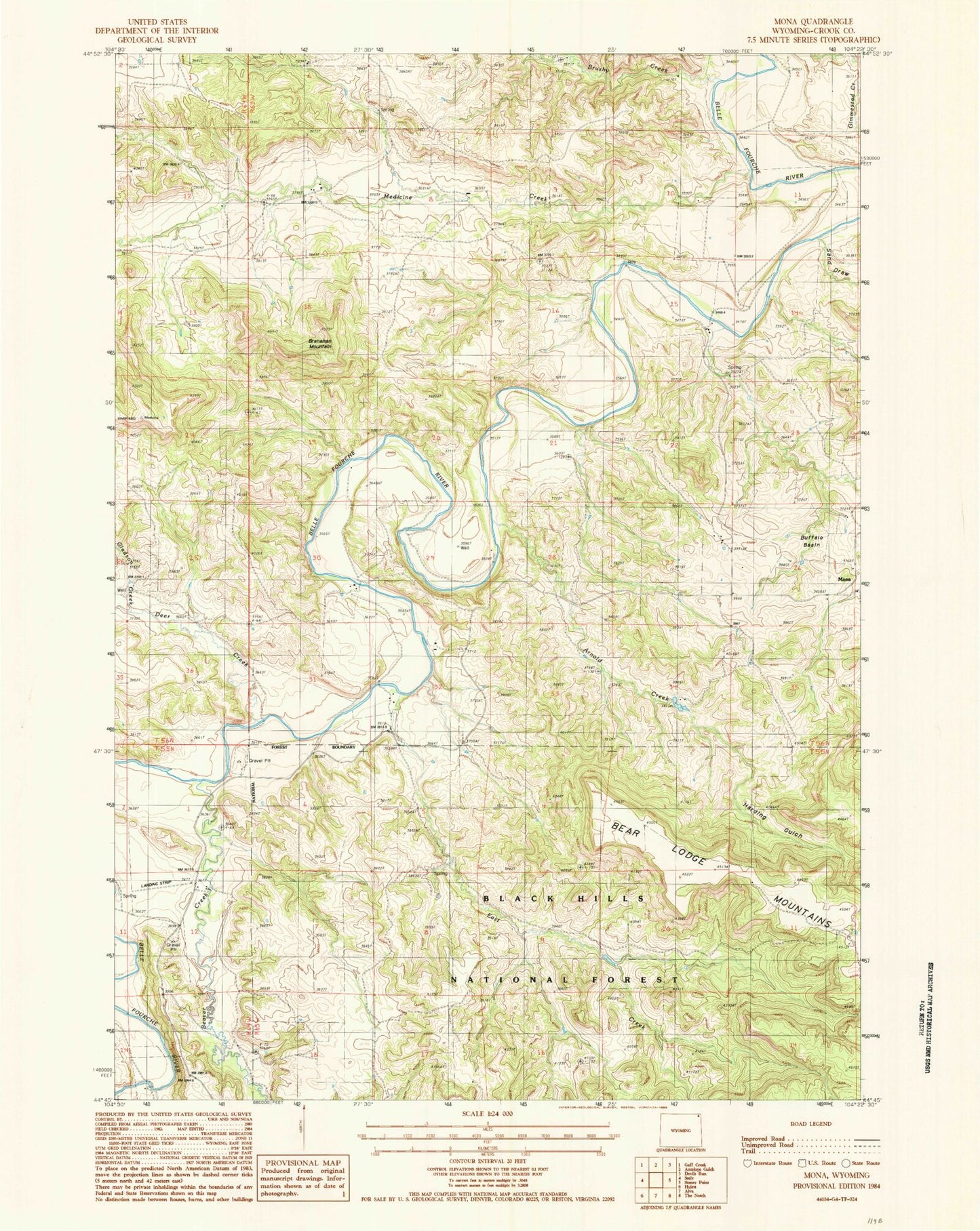
Classic USGS Mona Wyoming 7.5'x7.5' Topo Map
Couldn't load pickup availability
Historical USGS topographic quad map of Mona in the state of Wyoming. Map scale may vary for some years, but is generally around 1:24,000. Print size is approximately 24" x 27"
This quadrangle is in the following counties: Crook.
The map contains contour lines, roads, rivers, towns, and lakes. Printed on high-quality waterproof paper with UV fade-resistant inks, and shipped rolled.
Contains the following named places: Arnold Creek, Beaver Creek, Branaman Mountain, Brushy Creek, Buffalo Basin, Bunney Ranch, Cross Anchor Ranch, Deer Creek, Deer Creek School, Driskill Dam, Driskill Reservoir, East Creek, Gladson Creek, Harding Gulch, Mahoney Ranch, Martin Spring, McClure Ranch, Medicine Creek, Mona, Pannell Ranch, Red Arrow Dam, Red Arrow Reservoir, Sand Draw, Storm Ranch, Svoboda Ranch, T Cross T Ranch, Terhune, Viergutz Three Mine, Viergutz Two Mine