MyTopo
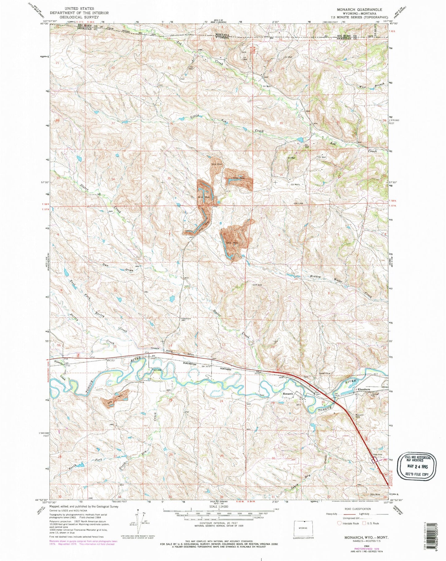
Classic USGS Monarch Wyoming 7.5'x7.5' Topo Map
Couldn't load pickup availability
Historical USGS topographic quad map of Monarch in the state of Wyoming. Map scale may vary for some years, but is generally around 1:24,000. Print size is approximately 24" x 27"
This quadrangle is in the following counties: Big Horn, Sheridan.
The map contains contour lines, roads, rivers, towns, and lakes. Printed on high-quality waterproof paper with UV fade-resistant inks, and shipped rolled.
Contains the following named places: Acme Number One Mine, Acme Number Three Mine, Armstrong Mine, Baldwin Dam, Baldwin Reservoir, Big Horn Mine, Black Mountain Mine, Buffalo Strip Mine, Carney Mine Number Forty-Four, Conable Prospect Mine, Dan Draw, Dietz Number One Mine, Earley Creek, East Fork Earley Creek, Evangelical Lutheran Cemetery of Monarch, Guernsey Stone Quarry, Kleenburn, Kleenburn Coal Tipple Mine, Kool Number Forty-six Mine, Little Ash Creek, Masters Mine, Meredith Dam, Meredith Reservoir, Model Mine, Monarch, Monarch Cemetery, Monarch Number Five Mine, New Monarch Mine, North Dry Creek, North Fork North Dry Creek, Old Monarch Mine, Riverside Mine, Sixmile Creek, Slater Creek, South Dry Creek, Tongue River Ditch, Welch Mine, Welch Strip Mine