MyTopo
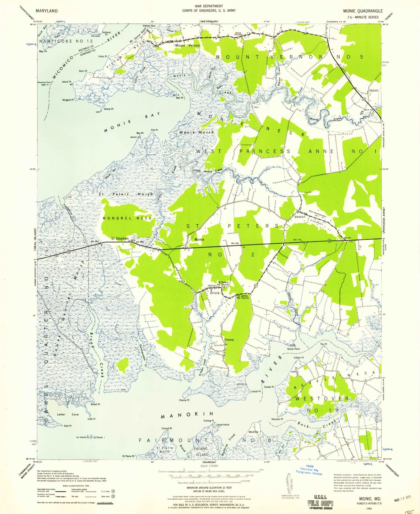
Classic USGS Monie Maryland 7.5'x7.5' Topo Map
Couldn't load pickup availability
Historical USGS topographic quad map of Monie in the state of Maryland. Map scale may vary for some years, but is generally around 1:24,000. Print size is approximately 24" x 27"
This quadrangle is in the following counties: Somerset, Wicomico.
The map contains contour lines, roads, rivers, towns, and lakes. Printed on high-quality waterproof paper with UV fade-resistant inks, and shipped rolled.
Contains the following named places: All Saints Church, All Saints Methodist Cemetery, Asbury Methodist Cemetery, Ashbury Church, Back Creek, Ballards Island, Bay Point, Bethel, Beths Gut, Big Gut, Bluemel Field, Broad Creek, Broad Point, Champ, Champ Point, Clifton Point, Cormal Point, Crab Point, Deal Island State Wildlife Management Area, District 2 Saint Peters, District 5 Mount Vernon, East Point, Edwin, Fishing Island, Fishing Point, Geanquakin Creek, Goose Creek, Goose Point, Grace Church, Harper Creek, Holland Point, Hughs Creek, Island Point, Iverness, Jason Creek, John Wesley Cemetery, Letter Cove, Letter Creek, Little Creek, Little Monie Creek, Locust Point, Macks Gut, Maddox Island, Marsh Gut, Mongrel Neck, Monie, Monie Bay, Monie Creek, Monie Island, Monie Marsh, Monie Neck, Monie Point, Monie Post Office, Mount Grace Episcopal Cemetery, Mount Olive Church, Mount Olivet Cemetery, Mount Vernon, Mount Vernon Beach, Mount Vernon Census Designated Place, Mount Vernon Elementary School, Mount Vernon Volunteer Fire Department Station 6, Nail Point, Oriole, Oriole Cemetery, Oriole Post Office, Pigeonhouse Creek, Pine Beach, Raccoon Point, Revels Point, Saint James Church, Saint Peters Church, Saint Peters Creek, Saint Peters Marsh, Saint Pierre Island, Saint Pierre Point, Saint Stephen, Saint Stephen United Methodist Church, Semi Point, Sob Point, Somersett Town, Top Point, Venton, Victor, Victor Creek, Victor Neck, Victor Point, Webster Cove, Wesley Church, Wingate Point, Wolftrap Creek