MyTopo
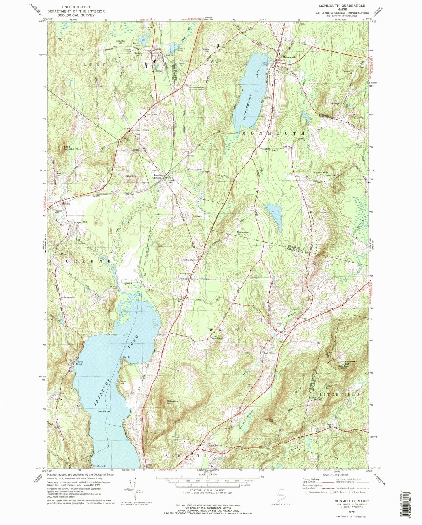
Classic USGS Monmouth Maine 7.5'x7.5' Topo Map
Couldn't load pickup availability
Historical USGS topographic quad map of Monmouth in the state of Maine. Map scale may vary for some years, but is generally around 1:24,000. Print size is approximately 24" x 27"
This quadrangle is in the following counties: Androscoggin, Kennebec.
The map contains contour lines, roads, rivers, towns, and lakes. Printed on high-quality waterproof paper with UV fade-resistant inks, and shipped rolled.
Contains the following named places: Bonny Pond, Cochnewagon Dam, Cochnewagon Lake, Cumston Public Library, Custer Pond, Danforth Hill, Dead River, East Wales, East Wales Cemetery, Golder Cemetery, Hodgman Hill, Hooper Brook, Island Pond, Keenes Corner, Keenes Corner Cemetery, Kimball Cemetery, Leeds Junction, Leeds Plain Cemetery, Libby Pit, Little Sabattus Mountain, Marr Point, Martin Point, Maxwell Cemetery, Maxwell Swamp, Mitchell Cemetery, Monmouth, Monmouth Center Cemetery, Monmouth Police Department, Monmouth Post Office, Monmouth Rescue Association, Monmouth Ridge, Monmouth Ridge Cemetery, Monmouth Volunteer Fire Department Center Station, Moss Cemetery, Nason Beach, Norris Hill, Oak Hill, Oak Hill High School, Pond Road Cemetery, Prescott Hill, Prescott Hill Cemetery, Sabattus Mountain, Sawyer Hill, Sawyer Memorial Church, Sprague Mill, Thompson Bridge, Thompson Hill, Town of Monmouth, Town of Wales, University of Maine Agriculture Station, Wales Airport, Wales Central School, Wales Corner, Wales Union Church, Wales Volunteer Fire Department, WARX-FM (Lewiston), WCBB-TV (Augusta), ZIP Code: 04259