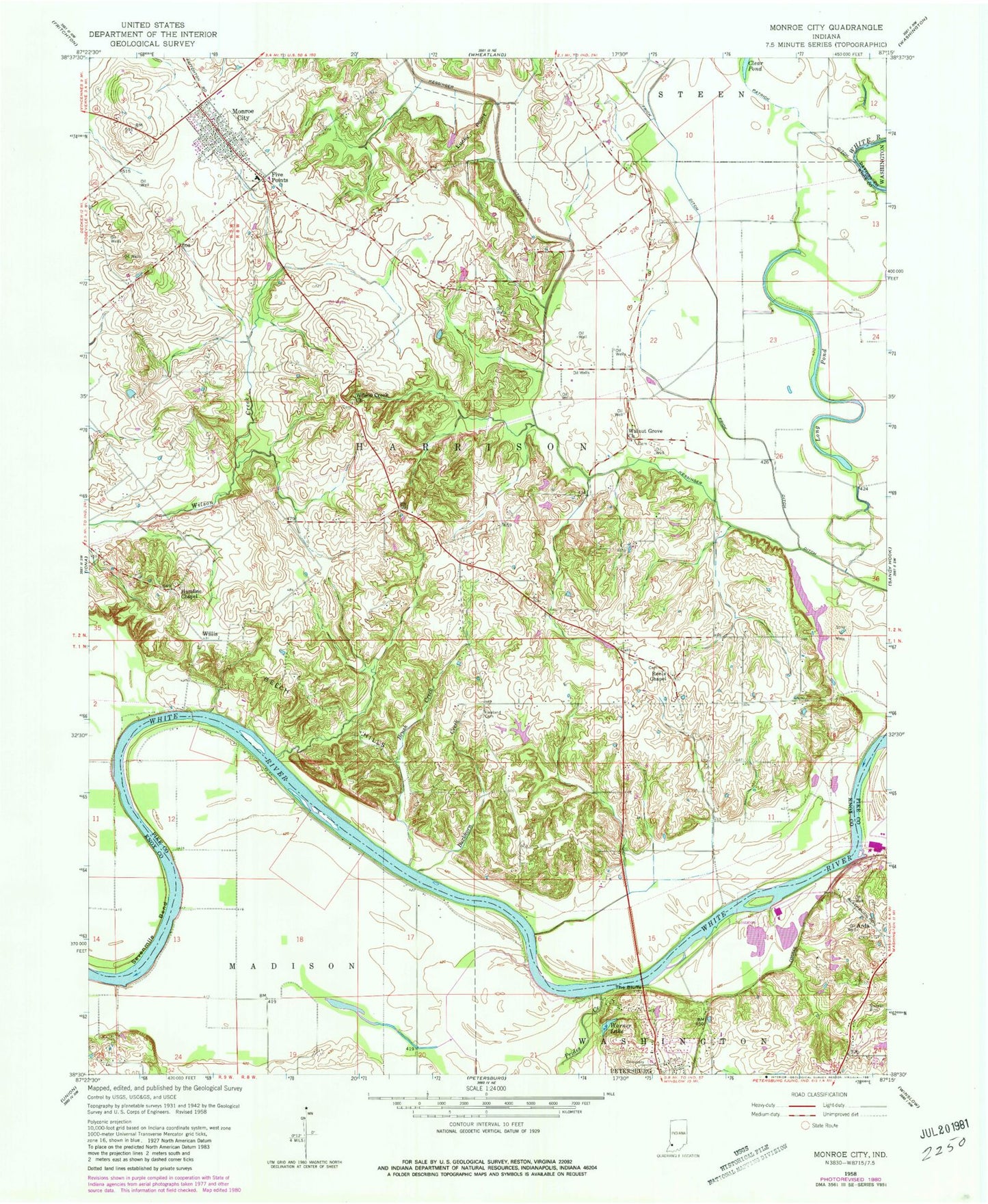
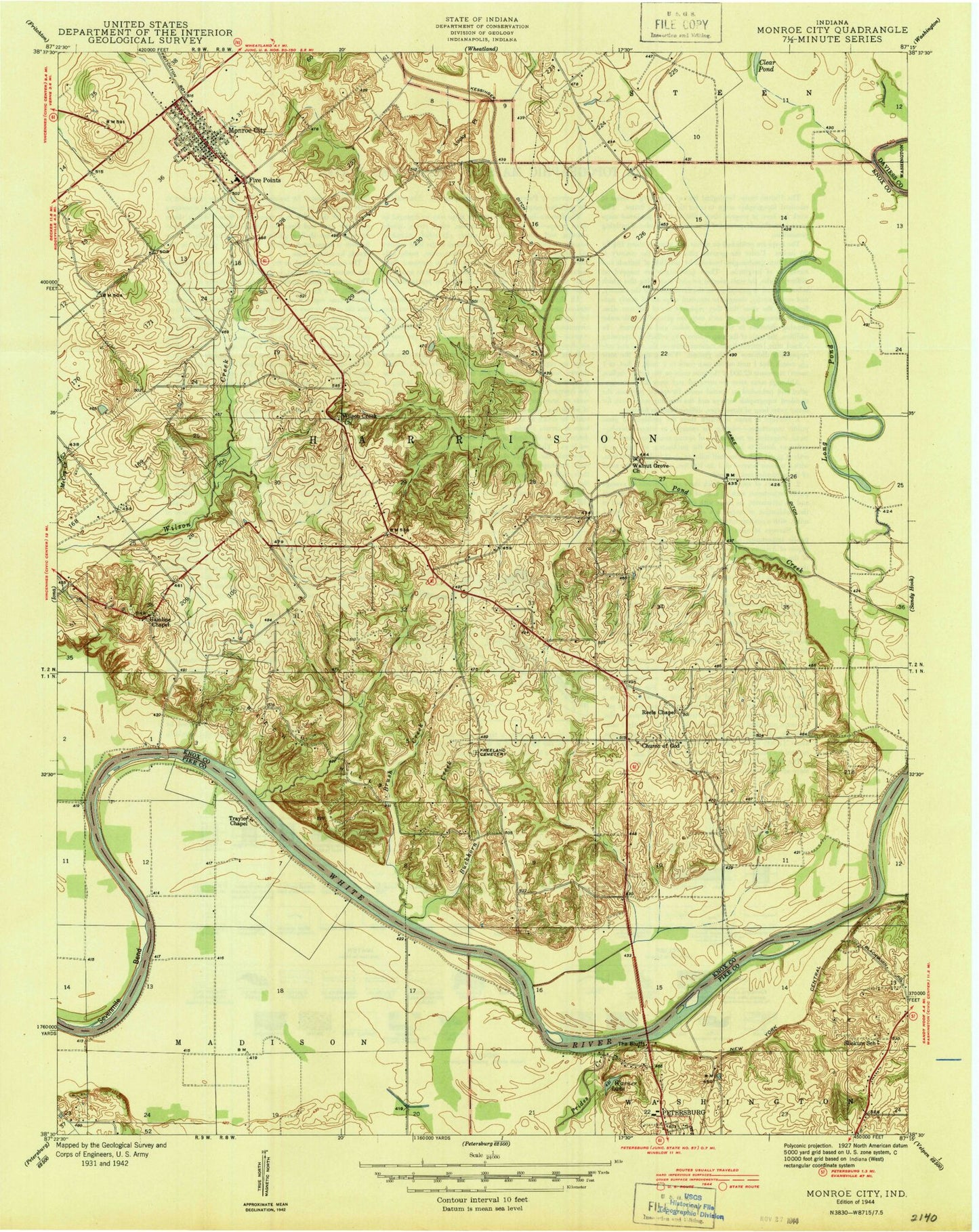
MyTopo
Classic USGS Monroe City Indiana 7.5'x7.5' Topo Map
Couldn't load pickup availability
Historical USGS topographic quad map of Monroe City in the state of Indiana. Map scale may vary for some years, but is generally around 1:24,000. Print size is approximately 24" x 27"
This quadrangle is in the following counties: Daviess, Knox, Pike.
The map contains contour lines, roads, rivers, towns, and lakes. Printed on high-quality waterproof paper with UV fade-resistant inks, and shipped rolled.
Contains the following named places: Arda, Bartons Location, Beech Hills, Brush Creek, Buckhorn Creek, Clear Pond, Farm Service Agency Interest of Indiana, Five Points, Freeland Cemetery, Frick Ditch, Hamline Chapel, Harrison Township Volunteer Fire Department, Lick Creek, Long Pond, Lucky Point, Monroe City, Monroe City Post Office, Patrick Ditch, Pond Creek Mills, Prides Creek, Sevenmile Bend, South Knox Elementary School, The Bluffs, Town of Monroe City, Township of Harrison, Walnut Grove Cemetery, Walnut Grove Church, Walnut Hill Cemetery, Warner Lake, Whiteriver Airfield, Willis, Wilson Creek Church, Wrights Ferry, ZIP Code: 47557