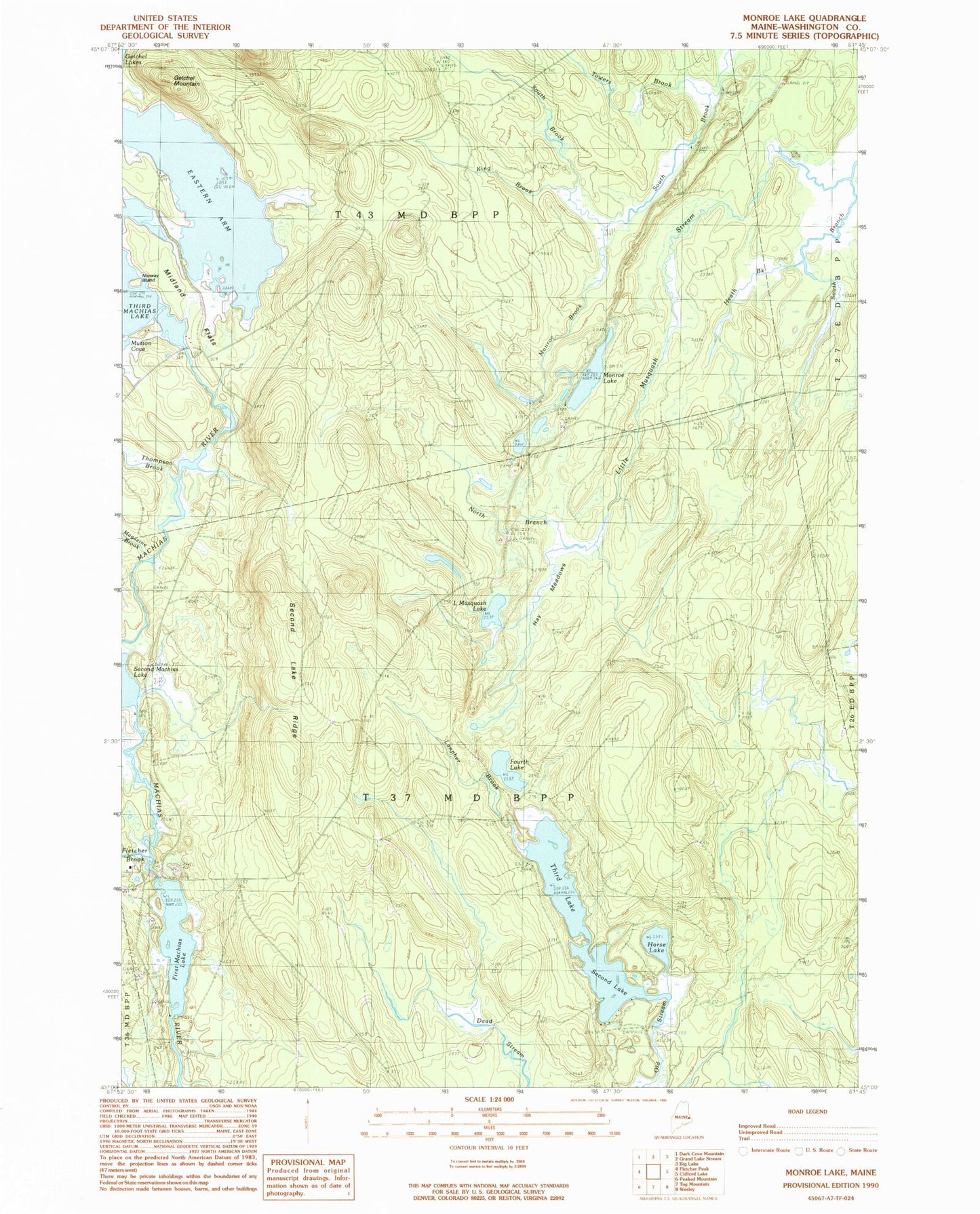
MyTopo
Classic USGS Monroe Lake Maine 7.5'x7.5' Topo Map
Couldn't load pickup availability
Historical USGS topographic quad map of Monroe Lake in the state of Maine. Map scale may vary for some years, but is generally around 1:24,000. Print size is approximately 24" x 27"
This quadrangle is in the following counties: Washington.
The map contains contour lines, roads, rivers, towns, and lakes. Printed on high-quality waterproof paper with UV fade-resistant inks, and shipped rolled.
Contains the following named places: Eastern Arm Third Machias Lake, First Machias Lake, Fletcher Brook, Fourth Lake, Getchel Mountain, Hay Meadows, Heath Brook, Horse Lake, King Brook, Lanpher Brook, Little Musquash Lake, Magazine Brook, Midland Flats, Monroe Brook, Monroe Lake, North Branch Little Musquash Stream, Norway Island, Second Lake, Second Lake Dam, Second Lake Ridge, South Branch Little Musquash Stream, T37 MD BPP, T43 MD BPP, Third Lake, Thompson Brook, Towers Brook