MyTopo
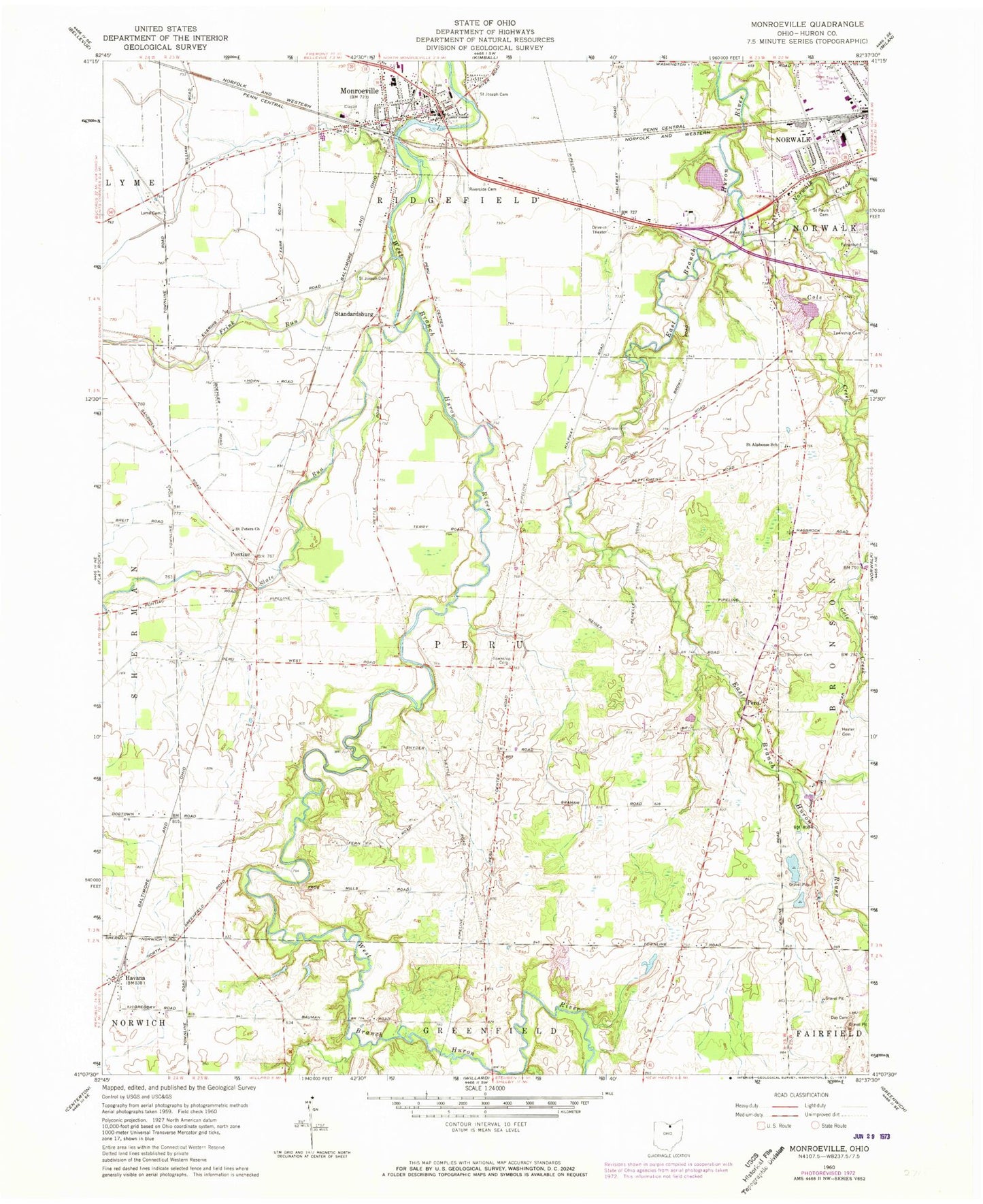
Classic USGS Monroeville Ohio 7.5'x7.5' Topo Map
Couldn't load pickup availability
Historical USGS topographic quad map of Monroeville in the state of Ohio. Map scale may vary for some years, but is generally around 1:24,000. Print size is approximately 24" x 27"
This quadrangle is in the following counties: Huron.
The map contains contour lines, roads, rivers, towns, and lakes. Printed on high-quality waterproof paper with UV fade-resistant inks, and shipped rolled.
Contains the following named places: Axe Factory Cemetery, Bronson Cemetery, Cole Creek, Contractors Realty Corporation Pond, Contractors Realty Corporation Pond Dam, Day Cemetery, Frink Run, Greenfield School, Havana, Hester Cemetery, Huron County Landfill, Huron River Joint Fire District, Laurel Hill School, Lyme Cemetery, Martin Farms, Monroeville, Monroeville Low Head Dam, Monroeville Low Head Reservoir, Monroeville Police Department, Monroeville Post Office, Monroeville Public Library, Norwalk Creek, Peru, Peru Center Cemetery, Peru Office, Pontiac, Pontiac Cemetery, Pontiac Post Office, Riverside Cemetery, Saint Alphonse School, Saint Alphonsus Catholic Cemetery, Saint Joseph Cemetery, Saint Joseph School, Saint Josephs Catholic Church, Saint Pauls Cemetery, Saint Peters Church, Sandhill Creek, School Number 1, School Number 10, School Number 4, School Number 6, Shield Dairy Farm, Slate Run, Standardsburg, Star View Drive-In, Township of Peru, Trinity Lutheran Church, Valley View Heliport, Village of Monroeville, Westwood Mobile Estates, Whispering Rain Farm, Zidar Farms, Zion Episcopal Church, ZIP Code: 44847