MyTopo
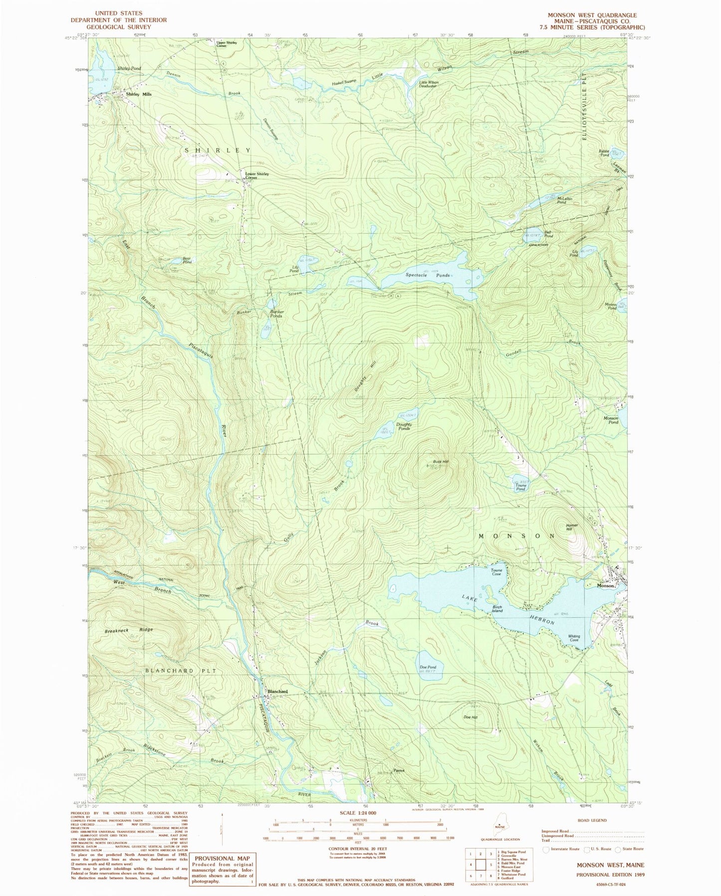
Classic USGS Monson West Maine 7.5'x7.5' Topo Map
Couldn't load pickup availability
Historical USGS topographic quad map of Monson West in the state of Maine. Typical map scale is 1:24,000, but may vary for certain years, if available. Print size: 24" x 27"
This quadrangle is in the following counties: Piscataquis.
The map contains contour lines, roads, rivers, towns, and lakes. Printed on high-quality waterproof paper with UV fade-resistant inks, and shipped rolled.
Contains the following named places: Bear Pond, Bell Pond, Birch Island, Blackstone Brook, Blanchard, Brackett Brook, Buck Hill, Bunker Ponds, Bunker Stream, Burma School, Dennin Brook, Dennin Swamp, Doe Hill, Doe Pond, Doughty Hill, Doughty Ponds, East Branch Piscataquis River, Gully Brook, Haskell Swamp, Lake Hebron, Homer Hill, Jackson Brook, Lily Pond, Lily Pond, Little Wilson Deadwater, McLellan Pond, Monson, Moores Pond, Rabbit Pond, Shirley Mills, Shirley Pond, Spectacle Ponds, Towne Cove, Towne Pond, West Branch Piscataquis River, Whiting Cove, Lower Shirley Corner, Parrot, Town of Monson, Shirley Pond Dam, Churchyard Cemetery, Monson Community Church, Monson Elementary School (historical), Monson Post Office, Shirley Mills Post Office, Shirley Volunteer Fire Department, New Blanchard Cemetery, Glenwood Cemetery