MyTopo
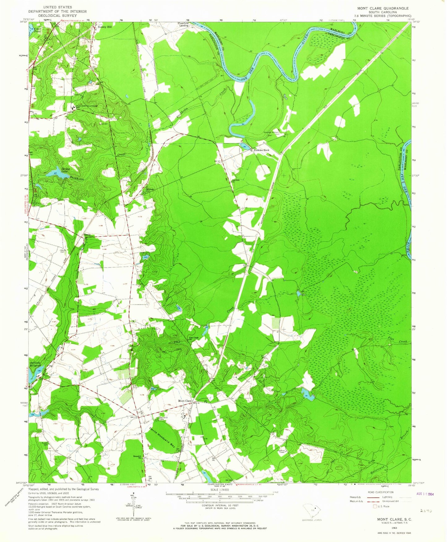
Classic USGS Mont Clare South Carolina 7.5'x7.5' Topo Map
Couldn't load pickup availability
Historical USGS topographic quad map of Mont Clare in the state of South Carolina. Map scale may vary for some years, but is generally around 1:24,000. Print size is approximately 24" x 27"
This quadrangle is in the following counties: Chesterfield, Darlington, Marlboro.
The map contains contour lines, roads, rivers, towns, and lakes. Printed on high-quality waterproof paper with UV fade-resistant inks, and shipped rolled.
Contains the following named places: Barn Plantation, Buckholtz Creek, Charles Mill, Cockers Falls, Coker Pond, Devils Woodyard Bay, Flat Creek Church, Gandy, Gandy Cemetery, Georgetown School, Governor Williams Cemetery, Jeffords Millpond, Jeffords Pond Dam D-3541, Lumber, Mont Clare, Mont Clare Lookout Tower, Montclare School, Mount Clare Baptist Church, Mount Rona Church, Parnell Cemetery, Red Hill Church, Red Hill School, Robbins Neck, Robbins Neck Station, Rosewald Consolidated School, Round O Cemetery, Round O Church, Round O School, Smiths Mill, Society Hill Division, South Carolina Noname 16008 D-3540 Dam, South Carolina Noname 16024 D-3539 Dam, Spring Lake, Wilbur Flowers Pond, Williams Lake, ZIP Codes: 29540, 29593