MyTopo
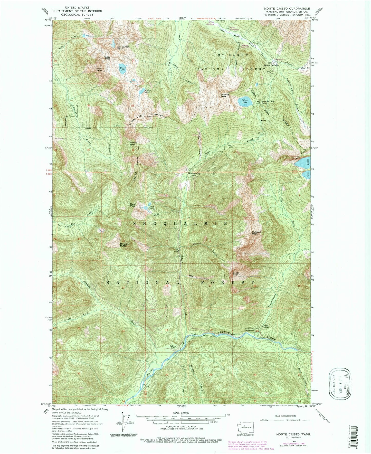
Classic USGS Monte Cristo Washington 7.5'x7.5' Topo Map
Couldn't load pickup availability
Historical USGS topographic quad map of Monte Cristo in the state of Washington. Map scale may vary for some years, but is generally around 1:24,000. Print size is approximately 24" x 27"
This quadrangle is in the following counties: Snohomish.
The map contains contour lines, roads, rivers, towns, and lakes. Printed on high-quality waterproof paper with UV fade-resistant inks, and shipped rolled.
Contains the following named places: Bear Creek, Big Gulch, Canyon Creek, Crested Buttes, Del Campo Peak, Foggy Lake, Foggy Pass, Galena, Glacier Creek, Gothic Peak, Gulch Lakes, Hard Pass, Hops Hill Campground, Howard Creek, Hubbart Peak, Lake Gulch, Lost Creek, Mineral Butte, Mineral City, Monte Cristo, Monte Cristo Campground, North Crested Butte, Poodle Dog Pass, Quartz Creek, Red Gulch, Salmon Creek, Sauk River Campground, Scott Peak, Seventysix Gulch, Sheep Gap, Sheep Gap Mountain, Silver Creek, Silver Lake, Silvertip Campground, Silvertip Creek, Silvertip Peak, South Crested Butte, South Fork Salmon Creek, Sultan Division, Sunday Falls, Troublesome Creek, Troublesome Creek Campground, Twin Lakes, Twin Peaks, Weeden Lake, West Fork Troublesome Creek