MyTopo
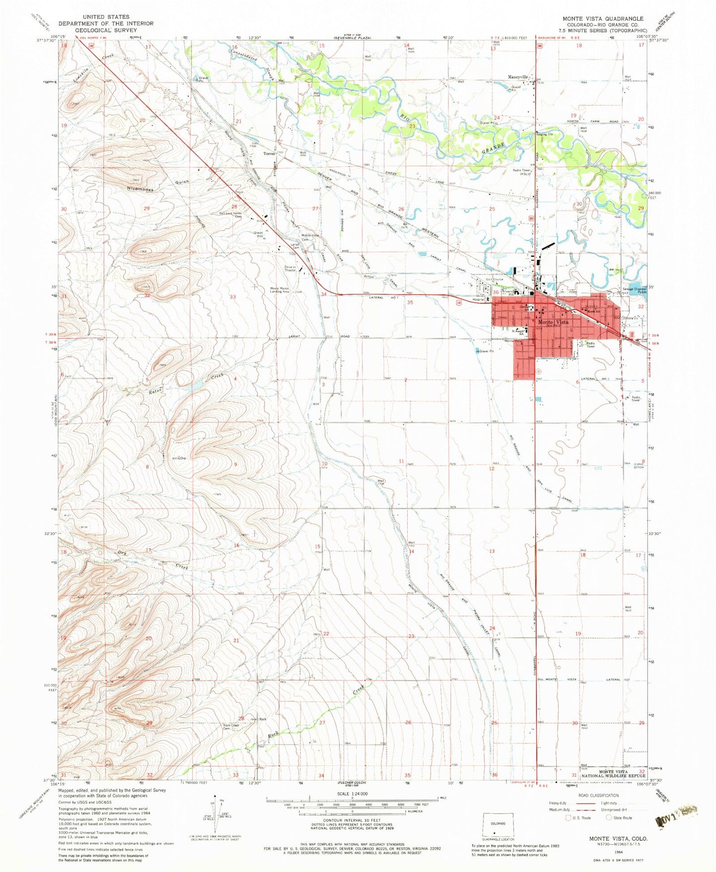
Classic USGS Monte Vista Colorado 7.5'x7.5' Topo Map
Couldn't load pickup availability
Historical USGS topographic quad map of Monte Vista in the state of Colorado. Map scale may vary for some years, but is generally around 1:24,000. Print size is approximately 24" x 27"
This quadrangle is in the following counties: Rio Grande.
The map contains contour lines, roads, rivers, towns, and lakes. Printed on high-quality waterproof paper with UV fade-resistant inks, and shipped rolled.
Contains the following named places: Anderson Ditch, Bill Metz Elementary School, Butler Irrigation Ditch, Cavalry Baptist Church, Church of Christ, Church of Jesus Christ of Latter - day Saints, City of Monte Vista, City of Monte Vista Facilities Building, Colorado State Patrol Monte Vista Post, Consolidated Slough, Dry Creek, First Baptist Church of Monte Vista, First Christian Church, Fish Ditch, Kingdom Hall of Jehovah's Witnesses, KSLV-AM (Monte Vista), KSLV-FM (Monte Vista), Lariat Cemetery, Lariat Community Baptist Church, Limekiln Creek, Marsh Elementary School, Maxeyville, Monte Vista, Monte Vista Cemetery, Monte Vista Division, Monte Vista Emergency Medical Services, Monte Vista Fire Department, Monte Vista High School, Monte Vista Lateral, Monte Vista Police Department, Monte Vista Post Office, Movie Manor Landing Area, Nicomodes Gulch, Presbyterian Church - First of Monte Vista, Raton Creek, Rio Grande and Lariat Canal, Rio Grande and Piedra Valley Canal, Rio Grande and San Luis Canal, Rio Grande Forest Supervisors Office, Rock Creek Cemetery, Saint Joseph Catholic Church Monte Vista, Saint Joseph School, Saint Peters Lutheran Church, Saint Stephen the Martyr Episcopal Church, San Luis Valley Cemetery, Seventh Day Adventist Church, Star Ditch, Torres, United Methodist Church, Valley Church of the Nazarene, ZIP Code: 81144