MyTopo
Classic USGS Monteagle Tennessee 7.5'x7.5' Topo Map
Couldn't load pickup availability
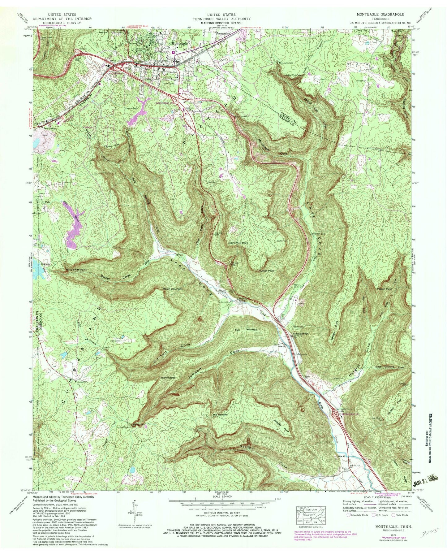
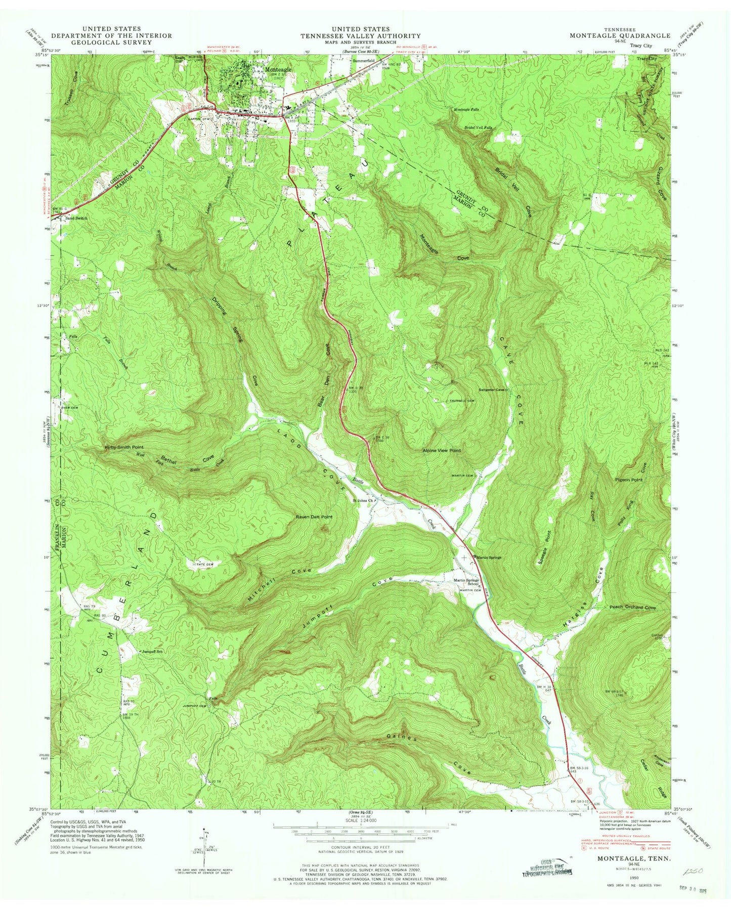
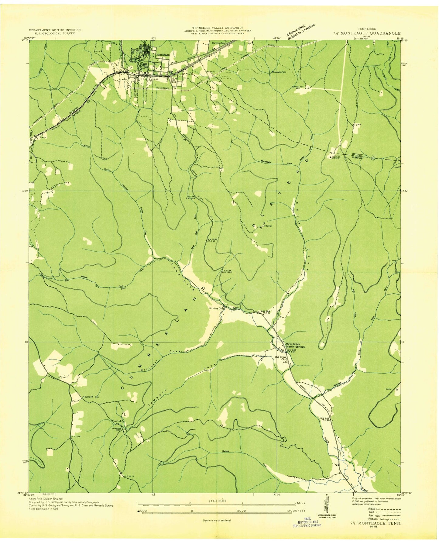
Historical USGS topographic quad map of Monteagle in the state of Tennessee. Typical map scale is 1:24,000, but may vary for certain years, if available. Print size: 24" x 27"
This quadrangle is in the following counties: Franklin, Grundy, Marion.
The map contains contour lines, roads, rivers, towns, and lakes. Printed on high-quality waterproof paper with UV fade-resistant inks, and shipped rolled.
Contains the following named places: Grundy State Forest, Speegle Point, Tate Cave Spring, Tate Cemetery, The Narrows, The Pinnacles, Trussell Cemetery, Trussell Point, White Cemetery, Wildcat Branch, Alpine View Point, Bear Den Cove, Bridal Veil Cove, Bridal Veil Creek, Bridal Veil Falls, Cave Cove, Drip Spring Cove, Falls Branch, Falls Branch, Flat Mountain, Gaines Cove, Hargiss Cemetery, Hargiss Cove, Hedrick Point, Jumpoff Cemetery, Jumpoff Church, Jumpoff Cove, Jumpoff Creek, Jumpoff Falls, Kirby Smith Point, Ladd Cove, Lappin Cemetery, Laurel Branch, Laurel Lake, Martin Cemetery, Martin Cemetery, Martin Cemetery, Martin Springs, Mitchell Cove, Monteagle Cove, Monteagle Falls, Payne View, Peach Orchard Cove, Pigeon Point, Polly King Cove, Raven Den Point, Ray Cove, Tom McBee Dam, Tom McBee Lake, Clifftops Lake, Clifftops Lake Dam, Bethel Creek, Bethel Creek Cove, Cave Cove Creek, Day Lake Dam, Palisades, Adams Mill (historical), Clifftops, Jumpoff School (historical), Martin Springs, Martin Springs School (historical), Monteagle School, Klepper Point, Monteagle, Saint Johns Church, Monteagle Cemetery, Saint Johns Cemetery, Martin Springs Baptist Church, Gaines Cove Branch, Hargiss Cove Branch, Roy Cove Branch, Monteagle Post Office, Dripping Spring Cove Branch, Jumpoff Cove Branch, Mitchell Cove Branch, Monteagle Cove Branch, Town of Monteagle, Monteagle Fire Department, Monteagle Police Department, Grundy State Forest, Speegle Point, Tate Cave Spring, Tate Cemetery, The Narrows, The Pinnacles, Trussell Cemetery, Trussell Point, White Cemetery, Wildcat Branch, Alpine View Point, Bear Den Cove, Bridal Veil Cove, Bridal Veil Creek, Bridal Veil Falls, Cave Cove, Drip Spring Cove, Falls Branch, Falls Branch, Flat Mountain, Gaines Cove, Hargiss Cemetery, Hargiss Cove, Hedrick Point, Jumpoff Cemetery, Jumpoff Church, Jumpoff Cove, Jumpoff Creek, Jumpoff Falls, Kirby Smith Point, Ladd Cove, Lappin Cemetery, Laurel Branch, Laurel Lake, Martin Cemetery, Martin Cemetery, Martin Cemetery, Martin Springs, Mitchell Cove, Monteagle Cove, Monteagle Falls, Payne View, Peach Orchard Cove, Pigeon Point, Polly King Cove, Raven Den Point, Ray Cove, Tom McBee Dam, Tom McBee Lake, Clifftops Lake, Clifftops Lake Dam, Bethel Creek, Bethel Creek Cove, Cave Cove Creek, Day Lake Dam, Palisades, Adams Mill (historical), Clifftops, Jumpoff School (historical), Martin Springs, Martin Springs School (historical), Monteagle School, Klepper Point, Monteagle, Saint Johns Church, Monteagle Cemetery, Saint Johns Cemetery, Martin Springs Baptist Church, Gaines Cove Branch, Hargiss Cove Branch, Roy Cove Branch, Monteagle Post Office, Dripping Spring Cove Branch, Jumpoff Cove Branch, Mitchell Cove Branch, Monteagle Cove Branch, Town of Monteagle, Monteagle Fire Department, Monteagle Police Department